Search This Blog (A.K.A. "I Dote On...")

Showing posts with label Central Corridor. Show all posts

Wednesday, June 9, 2010

Anarchy in Affton, and Other Reflections on St. Louis's Placeblogosphere

Does anyone know the whereabouts of one J. Patrick O'Brien, the "city" of Affton's onetime mayor? Has there been a coup?

On December 23, 2007, after a somewhat regular posting schedule, the esteemed pseudo-mayor of a pseudo-city (Affton is not incorporated) simply stopped posting. See for yourself here at his now-defunct blog: Mayor of Affton.

The Mayor offered St. Louis placeblog readers something we're all too light on: laughter. O'Brien would refer to his wife as the "First Lady" and his home, more than likely, being in Affton, a Tudor-style gingerbread or a Post-War saltbox, the "Mayoral Mansion".

Whether he reviewed the Affton restaurant scene...:

Last night the First Lady and I tried out the new Trattoria Toscana restaurant on Gravois next to the Ten Mile House. Let me first say that earlier I told a friend that I was going out to Affton's newest Italian eatery and he said "Fazoli's?" Chris, you are a jerk and so are you Fazoli's. I hate Fazoli's food and apparently they hate Affton since they don't have a location here.

...or faux-bombastically trumpeted his mayoral background in real estate development...


The Mayor attended a conference on Sustainable Development this morning hosted by the Urban Land Institute.  Most of the discussion was old hat for the Mayor as I am well aware of the concepts that create such developments.  What was enlightening was to see actual reports and data that proved the return on investment to developers that choose to “go green”.

...the Mayor of Affton was a delight to read.

If this were the end of the story, I'd be kind of depressed. With the passing of the Mayor of Affton blog, there was definitely a visible void, and not just in everyone's favorite South County hamlet. Our region needed more people writing about their neighborhoods, their municipalities, to get us excited and interested. Affton is one of the most stereotyped places in the region--it's all retirees, it's boring, it's not urban, etc.--yet I believe O'Brien opened our eyes to a colorful place. That's St. Louis--an impossibly varied kaleidoscope of villages.

So, it's important to note now, three years after Affton's Mayor disappeared from the blogosphere, that we have plenty of other Mayors running around town (keep in mind--some of these mayors predated the ascendancy of Foursquare!).

One of my favorites is Nicki's Central West End Guide. Neighborhood resident Nicki Dwyer snaps photos of businesses new and old, street life, flora and fauna, and more--all in the Central West End or nearby. By focusing on the life of the neighborhood, as opposed to blogs like mine that settle for our great, if inanimate, built environment, Nicki truly enlivens the neighborhood. I know she doesn't go by "mayor", but I'd vote for her!

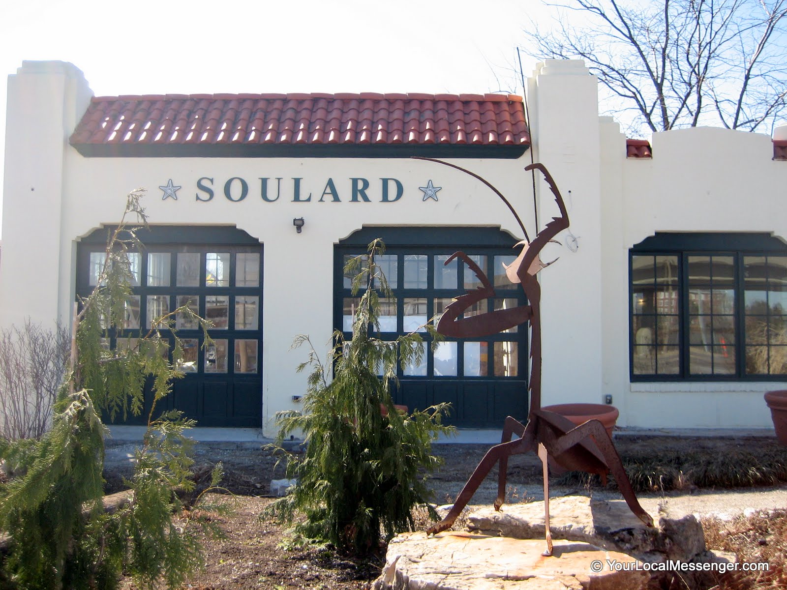
We now even have a Near South Side-centric neighborhood newspaper online, called Your Local Messenger, and an online-only (and VERY well done) North County magazine at NoCoSTL.

56 Houses Left dutifully and beautifully cataloged the long destruction of a North County neighborhood near the airport--the Carrollton Subdivision. In happier news, a swanky mid-century modern neighborhood of Crestwood (the Ridgewood subdivision) gets much love on this web site.

Old North St. Louis has a whole band of blogger-rehabbers. Check out 1318 Hebert and the 3 Walls Project (covering the process of a stunning renovation at 3240 N. 19th). Our Little Easy hasn't been updated in a while, but is worth a look.

So, neighborhood mayors out there reading this--urban, suburban, rural, it matters not, of course--please send us your placecentric blogs so that we can all rest assured that the faux-Mayoral blogging doesn't have a term limit.

Tuesday, June 8, 2010

East Loop Redevelopment Falls a Bit Short; Make a Call to Improve It!

When Neal Shapiro of Original Cast Lighting announced he was packing up his business and taking it from the East Loop to Westport Plaza, he promised his presence on Delmar would not fade.

Now, the Summer 2010 issue of the Times of Skinker-DeBaliviere has the proof: Shapiro's rendering for the site at 6108 Delmar.

Here is the before, from Google Streetview:


And the rendering, from the Times of S-D.


As you can probably tell, half of the building (a non-contributing addition to a historic building) is slated for demolition while the other half will be surface parking.

Skinker-DeBaliviere Community Council supports the plan with minor alterations, saying that "this additional parking will be a welcome addition to the Delmar streetscape and complement the renovation of the historic OCL building...". While I respect this neighborhood group greatly and feel that their newspaper is among the city's best, I disagree with them entirely on this point.

The East Loop is at a point, urban-design wise, where it could really take off and be seen as a cohesive district on par with the western portion of the district. The African American Cultural Center (shown below) will fill in a large gap in the street wall, but the East Loop still has plenty of blank space.

Image Source: Terrence Says

If you need confirmation of this, step up to the rooftop bar at the new Moonrise Hotel.


This humongous gap between the East and West Loops is bad enough--why create more gulfs between activity?

I understand that the Loop is a regional destination and that most people drive there. That said, the Loop is actually not a huge district. Able-bodied individuals should park at the gigantic surface lot behind Delmar between Leland and Kingsland and walk to the East Loop if that's their destination. If you want to grab-and-go, try street parking, which is usually available if it's not a weekend or a popular Pageant show. Let's not forget to mention that there is a Metrolink stop a block away from this site--and a proposed Loop Trolley that would run right outside the front door. Those who wanted to avoid a parking headache in the Loop could  always take one of the many other forms of transportation (I didn't even mention the bus...) to get there as well, possibly with a park-and-ride situation if they still wish to drive at all.

The Loop has the greatest potential of all business districts in St. Louis to become even more of a showcase of how active, urban, and lively St. Louis can be. Parking lots suck energy away, especially when they're visible. If it's determined that parking is absolutely necessary for the site, why not hide it? Keep the facade of the building to be demolished intact, paint it, and let it at least hold down a proper street wall for the East Loop. This would be a very creative use of the building and a better public face for Delmar than a brick wall screening surface parking.

If you agree with me, please contact the Skinker-DeBaliviere Community Council below:

6008 Kingsbury Avenue 
St. Louis, MO 63112 

Voice: (314) 862-5122 
Fax: (314) 862-5153 

Email: beverett@skinker-debaliviere.com

As I said before, I respect the work of this great neighborhood association, but it's their word that will allow, or block, more surface parking on Delmar in the East Loop. Remember--this is St. Louis's premiere urban strip. Why can't we put a better face out to the world than striped parking spaces? I think we can!

Thanks to the Urban St. Louis forum for this story idea.

Thursday, May 13, 2010

Preliminary May Preservation Board Agenda Includes Demolitions, New Bike Rack

On the latest temporary Preservation Board agenda, BJC Healthcare is seeking the demolition of two buildings for a new patient care center. The addresses are 4948 Parkview Place and 329 S. Kingshighway. These are the old Jewish Hospital buildings.

Vanishing St. Louis warned us of these proposed demolitions back in February of 2008. Here is a picture that author Paul Hohmann snapped then:


I am against a proposal that calls for the demolition of fine old buildings just to create new buildings that are blandly deferential to the monochromatic "campus" aesthetic. For Washington University's Medical Campus, this means a beige building with blue glass. No thanks, if that's the plan.

Also on the agenda is a proposal to install a five-foot tall Eiffel Tower sculpture doubling as a bike rack outside of new Lafayette Square cafe Rue Lafayette.

Also in Lafayette Square, there is a proposal to construct a home on the vacant lot at 1117 Dolman. My old block of Dolman appears to being doing well. Just south of here, the Preservation Board has granted approval to single-family home construction on another grassy lot. By a Google Streetview survey, yet another large empty lot on Dolman has a sign with some model homes on it further down the street. Maybe Dolman can soon mirror the success of the rest of the neighborhood with sensitive infill consuming its unfortunate gaps.

A new single-family home will join this row soon, if approved by the Preservation Board in May.

See the temporary agenda here.

As always, I encourage readers to attend Preservation Board meetings and testify for the items for which they are passionate:

The St. Louis Preservation Board will meet on May 24th, 2010 at 4:00 P.M. in the Cultural Resources Office of the Planning and Urban Design Agency, 1015 Locust Street, Suite 1200.

Thursday, April 29, 2010

Archgrounds Design Competition: Its Participants and Their Design Philosophies

St. Louis Energized has a nice write-up on last night's "Meet the Designers" session for the City Arch River 2015 competition, which was held at the Roberts Orpheum Theater downtown.

The author summarized the five teams still vying in the competition along with their design philosophies, presented in brief, 15-minute presentations in which no questions were allowed from the audience.


    • The Behnisch Team focused on the "needs of people" (stating that a "good city is a city with a human dimension"), as well as the built environment by calling for the Memorial to become an "active catalyst for urban cohesion." 

    • The approach of the MVVA Team seems primarily landscape-oriented, stressing that landscape (1) accommodates a humane scale, (2) provides continuity, and (3) is affordable.

    • The PWP Landscape Architecture, Foster + Partners, Civitas team (whose representative personally knew both Eero Saarinen and Dan Kiley) advocated "subtle and respectful" changes that, while transformative, are so natural that they're barely noticeable to the majority of the public.

    • The SOM, Hargreaves, BIG team stressed "making places for people" (places that are "alive" every day), as well as tying design ideas into a community's bold, long-range plans to "create economic vitality."

    • The Weiss/Manfredi team referred to three primary design categories, titled "Icon and Setting," "Connections," and "Layering Programs." The interesting facet of this team's approach was an affinity for embracing barriers (such as highways), by turning them into connections and "capturing their energy" without actually removing them.

Reading Live Tweets from the event, as well as the above summary in addition to others, I must say I am a bit worried that the most obvious problem of the Archgrounds may not receive its due attention and the needed ultimate solution. Interstate 70 from the Poplar Street Bridge all the way to the New Mississippi River Bridge is the obvious problem. Wholesale removal is the needed ultimate solution. I-70 will be re-routed upon completion of the new bridge anyhow, and connecting the Arch to neighborhoods should take this very symbolic and helpful step. An open doorway with a removed I-70 will literally allow surrounding neighborhoods a brand new view of, and connection to, the Arch. I fully endorse this concept and support City to River's effort to make this solution part of any proposal to redevelop the Archgrounds.

It's important here to note the ramifications of the removal of I-70. Does a removed I-70 promise instant development along the old interstate right-of-way? Of course not. The land where the highway once sat, upon removal, might sit as a landscape boulevard with few buildings of note for quite some years. Almost certainly, the entire 1.4 mile stretch of the new Memorial Drive that would take the place of the old I-70 will not be filled with urban-formatted buildings by the time the design competition's winning proposal is completed in 2015. This sounds very pessimistic, right? It seems to defeat the purpose of undertaking something so exciting and momentous as giving a stretch of road back to the city and its people rather than to speeding vehicles. After all, if the "new" Memorial Drive is in fact just a landscaped but largely lifeless boulevard in 2015, City to River will have failed and all skeptics of the City to River concept will have been vindicated, right?

Wrong (at least in my opinion!). An empty, but pedestrian-oriented, Memorial Drive will create an opportunity that does not presently exist--development could then locate on the periphery of the Archgrounds and create a "spine" of activity linking neighborhoods to the north (Carr Square, Columbus Square, Neighborhood Gardens, the Bottle District, Laclede's Landing, the Near North Riverfront, etc.) to their downtown. The present mess made by I-70 as it slices through a once functional grid is reason enough to abandon this alignment. Pedestrians and vehicles alike could safely maneuver a reconstructed street whereas I-70 today merely creates confusion and barriers.

As far as the new Memorial Drive proposed by City to River, and the possibility that it might not attract builders to populate the newly developable parcels, I point you here:


The year is 1951 and these jets are flying just northeast of today's site of the Gateway Arch, which was completed in 1965. It was in 1947 that Eero Saarinen's Gateway Arch concept won the international design competition. In anticipation of the competition, most of the dozens of square blocks containing an antebellum manufacturing district were cleared in the early 1940s. So, if all building were gone from the site by 1942, and the site was a surface parking lot, as seen above, by 1951, then for at least 14 years the site of the memorial was not truly public. Considering that the Jefferson National Expansion Memorial didn't even officially open to the public until 1967, we see here that the same competition that netted the ingenious Arch design caused a 40-block swath of the city to go out of commission for over a decade. (I don't count parking lots, even publicly owned and maintained ones, as public places). If this is true, then we should allow for the same grace period for a new Memorial Drive in anticipation of its own greatness. That doesn't mean we as a city shouldn't aggressively market this newly available land or that the design competition won't cause an increase in demand for these blocks. It's just a plea for skeptics to realize that sometimes, as the old moniker goes, great things come to those who wait. The old I-70 alignment's erasure will have been more than justified if, in ten or twenty years, a new Memorial Drive is beginning to kick and thrive.

Now back to the buzz over the five teams. Not having seen the actual presentation, it's difficult to pass any substantive judgment on their concepts. As written up by St. Louis Energized, I despise the idea of Weiss/Manfredi. St. Louisans have had to limbo around barriers long enough! There are no LCD screens; no garish light displays; no amount of lush greenery or ivy screens; there is no sculpture large enough; no pedestrian bridge crazy enough; no public-space-beneath-the-interstate-avant-gardeism impressive enough; no single or multiple solutions to screening and/or incorporating deadening infrastructure into the redesign. While this is surely an interesting proposal from a conceptual standpoint, the design will be inhumane, no matter how flashy it is, if it values "concepts" over people and access. So I am turned off by this description of their philosophy entirely.

I am surprised at the suggestion of the PWP, et al. crew to make changes that are "barely noticeable" to the public. We must keep in mind that the Archgrounds are quite large and that, preserving the landscape largely as is requires that activation efforts on all edges of the Memorial be stepped up considerably. People need to be able to appreciate the passive landscaping of the Archgrounds, or otherwise the respect for its presence in this competition is somewhat ill-founded.

Many of the teams correctly identified that the Arch redevelopment, ultimately, should cater to people. This is a great though often overlooked observation--especially as traffic engineers crunch numbers and determine that the needs of cars somehow take precedence over the needs of people in what should rightfully be the region's greatest civic and public space.

I would not mind a design proposal that dedicated most of its time to addressing issues presented by having an interstate as a neighbor. Remove I-70 (do not tunnel it and merely hide the problem for just four blocks). Incorporate retail or tourist-supporting services within the arches of the Eads Bridge piers. Redesign parking for the site so that the northern edge of the Memorial visually and physically connects with Laclede's Landing and points north. Landscape the riverfront itself--certainly it is one the nation's most barren urban riverfronts today. Have water taxis or some sort of pedestrian bridge to connect to East St. Louis; see to it that the East St. Louis Riverfront indeed becomes home to the world's largest architecture museum, as proposed and sought by the St. Louis Building Arts Foundation. Enhance pedestrian connections to Chouteau's Landing; allocate some funding to the Chouteau Lake and Greenway to jumpstart that project. And so on and so forth. All of these interventions would make the Arch more of a "place" situated in a context--and little would have to be altered within the existing landscape other than its worst features currently, the parking garage and floodwalls.

Despite my earlier comments, I am absolutely thrilled by the excitement over this competition. Its outcome and winning proposal could truly lift the spirits of our city and give us all a place we're proud of. The Arch, downtown, the Mississippi River, and the city deserve it!

Tuesday, April 27, 2010

Will a Gate District Landmark Soon be Reborn?

The Garavaglia Grocery complex at Lafayette and Nebraska in the Gate District is something of a faded landmark. It is shown below, courtesy of Google Streetview:


Why do I ask if it's soon to be rescued from its vacancy?

Well, on March 31, 2010, the Garavaglia buildings were listed on the National Register of Historic Places. The nomination contains some excellent photography of the interior of the building, so I would recommend checking that out!

Why would the owner, listed by the city as Garavaglia Quality Foods, have sought historic status? Could it be to renovate the building and take advantage of the state historic rehabilitation tax credits? Possibly.

Could work begin soon on this Gate District landmark? Anyone have the scoop?

Sunday, April 25, 2010

Cultural Resources Office Recommends Denial of Demolition Permits on Chouteau

 UPDATE (4/27/10): The Preservation Board has denied the appeal for demolition of the buildings shown below! Great news!

The Cultural Resources Office (CRO) is encouraging the Preservation Board to deny the appeal of owner Crown 40, Inc., a convenience store operator, who wishes to tear down a row of four buildings on Chouteau.


The CRO staff report notes that Crown 40 seeks to demolish the four buildings to keep them as "grassy lots" in lieu of future development. Thankfully, the CRO does not feel that this "plan" constitutes a true development plan for the sake of the preservation review ordinance. They note, rightly, that none of the Chouteau buildings individually is significant, but, as a group, they make an important contribution to Chouteau's urban street wall.

Hopefully, the Preservation Board will heed to advice of the CRO and deny what would be a senseless plan to demolish four buildings just to create vacant lots. The Board meets Monday, April 26, at 4pm. The location is 1015 Locust, Suite 1200.

The CRO report also includes several buildings--and a new historic district in Tower Grove South called Oak Hill--that will be added to the National Register of Historic Places.

Friday, April 23, 2010

Another Gas Station on Chouteau?

Gas station, then-under construction, now complete, at Jefferson and Clark

Quick note: the reason for this month's proposed demolitions on Chouteau Avenue in the Gate District is a familiar, though saddening one: to make way for a gas station. Michael Allen of Ecology of Absence has made the connection I did not: that applicant Crown 40 is related to the convenience store chain of the same name. I should have known.

The loss of any urban buildings to a gas station is unacceptable. With a new gas station located mere blocks away on Jefferson just north of I-64/40 (its construction site is shown above), this proposal is ludicrous.

I must urge you to testify at the Preservation Board meeting if you are available. Do not stand by to watch an urban design disaster take place. Vote, with your testimony, for a city built for pedestrians, not automobiles exclusively.

Monday, April 26, 2010 at 4pm
1015 Locust
12th Floor Conference Room

If you cannot make it in person, please send your testimony to BufordA@stlouiscity.com.

Monday, April 19, 2010

Conceding Tucker Boulevard to Blandness

St. Louis doesn't have a system of comprehensive planning. Thus it surprises few observers in the urbanist community when an individual developer floats his or her project without regard to its surroundings.

Today comes (overall, great) news that the AFL-CIO Trust will commit $108 million to two downtown development projects--the Laurel Building (also known as the Dillard's Building) and the Park Pacific building at 13th and Olive.

So what's the bad news? Tucker Boulevard--a street whose grandiose size might confuse visitors into thinking it's St. Louis's "Main Street"--is being dedicated as the parking garage elevation for the Park Pacific building's redevelopment. A tiny rendering is shown in the article:


Some might say, in autocentric St. Louis, it's necessary to have dedicated parking (it's probably also tied to financing, in some way). Truthfully, I don't dispute that some parking is needed to redevelop this building. However, the above rendering is unacceptable for Tucker Boulevard if this street is ever to become active, urban, and attractive.

The City of St. Louis recently constructed a monster of a parking garage at the northeast corner of Tucker and Clark. See a Google Streetview capture of the garage, without its retail bays added as of yet, below:


I commend the city for attempting to make a statement with a parking garage rather than constructing a series of bare concrete decks (sort of like the kind shown in the Park Pacific rendering, on the north side of the site). However, parking is in severe oversupply downtown when all off-street spaces are accounted for. And the Tucker garage shown here at Clark Street is not even attached to any one project--it's a municipal garage. If every downtown redevelopment project includes its own dedicated parking garage with more than one space per visitor or resident, not to mention separate municipal garages, opportunity for a true urban environment is squandered. Transit is disincentivized as driving becomes easier. Every new parking space drives the cost of parking down, and as parking becomes cheaper, it becomes the better option. Convenient parking reduces walking times and distances, cutting down the chances that a pedestrian will linger downtown and walk around to discover its retail, restaurant, and entertainment offerings.

But this post is not even really a statement against downtown St. Louis's parking oversupply, primarily. It's about poor urban design on one of St. Louis's major downtown streets. Across from the new municipal garage at Tucker and Clark is a surface parking lot serving City Hall. Just north of the Gateway Mall blocks are the Park Pacific site, a pair of deadening and severe mid-rises, a woefully underused parcel that a one-story US Bank branch sits on, and several other gaps as well. Filling in the Park Pacific site with an unsightly parking garage relegates Tucker to third class status as an urban boulevard.

I wrote on a previous post in agreement with a statement that said people desire to live in cohesive urban environments. That means that few people will be proud of a place that is beautiful in one area (Washington Avenue), while dreary just a block or two over (Tucker Boulevard). We must reposition our downtown so that its dead zones are not so apparent.

Park Pacific developers should include a four-story mixed-use building that wraps Tucker, Pine, and Olive on all sides. Parking could be hidden in the core of this building. Street-level retail is not enough to mitigate the damage of exposed parking decks on a street with as many issues as Tucker has already. Here is an example of what I mean, from Baltimore's Fells Point neighborhood.


This new mixed-use building may not be flashy, but it's a nicely scaled urban building. Do you see its attached parking garage? I don't.

Walk too fast and you might even miss the spot to pull in to its large dedicated parking garage. It's located behind the building, on the inside and invisible to the public portion of the block.


Park Pacific should not proceed with plans that would concede Tucker to blandness. It's a visually important street for St. Louis.

Tucker--once 12th Street--has an important legacy that should be respected. 12th Street was once symbolic enough of St. Louis for postcard representation.


Especially as St. Louis bids for the Democratic National Convention and wishes to play host to tens of thousands of visitors from across the nation in 2012, we should be cleaning up the face of our region--downtown St. Louis--not further scarring it.

Thursday, April 1, 2010

Winners of Archgrounds International Design Competition to Frame a Modern Masterpiece...

...with the Serra Sculpture, AKA Twain (pictured below).


A source who wishes to remain anonymous has leaked the winning proposal of one of nine teams behind the City.Arch.River2015, the international design competition for the Archgrounds in downtown St. Louis.

The ever-controversial Serra Sculpture will be relocated from its current spot on Market between 10th and 11th Streets to the large lawn fronting the Arch, only several yards from Memorial Drive. The much-maligned "depressed section" of I-70 will remain as is. So too will its elevated portion near Laclede's Landing.

I am told that the winning team--also not to be announced yet--was selected for their design's "thoughtful reflection on the 'less is more' school of modernism".

"The winning team was believed to have stayed most true to the modernist spirit of the Archgrounds. What's more modern than a depressed interstate?" my source rightfully asked.

Below is a preliminary rendering of the proposal.

 Above, the Serra Sculpture will soon frame the Arch and Old Cathedral. Not to scale.

Think it's a little bare bones? Well, the multi-million dollar budget of the Framing a Modern Masterpiece design competition was completely gutted when, out of the blue, the National Park Service threatened to relocate the Gateway Arch to Clayton's Shaw Park, forcing the City of St. Louis to offer $10 million in tax credits for the iconic monument to remain in its historic location.

Reportedly, the second place team proposed reinstalling the St. Louis Centre skybridges over the depressed section of I-70 to allow for better connections between downtown and the Archgrounds. Competition judges felt the 1980s mall appendages were too garish and clashed with the minimalist 1960s-design of Interstate 70.

More details as they emerge.

Monday, March 22, 2010

Preservation Board Updates

Quickfire update! (Click here if you have no idea what this post is referring to...).

-6169R Pershing, owned by Washington University Quadrangle Housing, was denied its retroactive demolition permit and will be going to housing court.

-4269 Westminster (AKA 414-18 Boyle); Board upheld staff denial of demolition permit.

-6102 Michigan; Board upheld staff denial of demolition permit.

Great news! But will they be back on the agenda next month?

Information Source: Michael Allen

Saturday, March 20, 2010

Full March Preservation Board Agenda Online

You may access it here.

As reported earlier, the agenda contains three demolition-related items. All photographs used within this post are courtesy of the Cultural Resources Office.

6169R Pershing in Skinker-DeBaliviere is a rear structure that has already been demolished. Applicant Washington University Quadrangle Housing is applying for a retrograde demolition permit to approve work that is already completed. The structure was built in 1910. Cultural Resources staff recommend denial of the permit application and referral of the owner to Housing Court.

6169R Pershing prior to demolition.


4269 Westminster (414-418 Boyle) in the Central West End is a one-story, brick commercial building in a largely residential section of the neighborhood. Core Holdings, LLC is seeking the demolition permit for public safety reasons. However, the building has not been condemned by the Department of Public Safety and is considered sound under the historic district ordinance. The Cultural Resources Office staff recommends   upholding staff denial of the demolition permit.

A front profile of the commercial building facing Boyle.

A detail of the parapet.

6102 Michigan in Carondelet is a two-story residential building. Owner James B. Fritz is seeking a demolition permit to create a garden and planted area. The Cultural Resources Staff notes that this building is a High Merit and structurally sound contributor to the third extension of the Central Carondelet National Register Historic District. Cultural Resources speculates that, due to the pitch of the roof and the rear flounder-style construction, this is likely a mid-19th century building that was later altered to fit its decidedly Arts and Crafts surroundings. The blockface of 61xx Michigan is entirely intact. Cultural Resoures recommends upholding staff denial of the demolition permit, as the building is an important structure and rehabilitation is likely feasible.

Front detail of building proposed for demolition.

Rear detail. Note the historic flounder-style roof pitch.

As always, I encourage readers to show up to Preservation Board meetings and testify!

Without the voice of the public present, the case for demolition is stronger. You really could be the difference in saving some of St. Louis's unique architecture! If you absolutely can't show up in person, at least make sure to email the Board. Contact information and meeting information is below!

Contact: Adonna Buford

Monday, March 22, 2010
1015 Locust, Suite 1200
4:00pm

Friday, March 19, 2010

Ferguson Says 'No' to CVS

As recently reported by NoCoSTL.com, CVS officials have dropped plans for a CVS store at North Florissant and Hereford Avenues in the North County municipality of Ferguson.

CVS wished to demolish seven historic homes in Ferguson to shoehorn one of its generic suburban stores onto a lot conveniently located across the street from arch rival Walgreens.

We've seen this move by CVS before. The pharmacy giant built a store catty-corner to a Walgreens on Gravois in Boulevard Heights, taking several homes down with it. A proposed CVS on Lindell nearly demolished three buildings off of the landscape before being called off, more than likely due to issues with usage of the alley for the drive-through. The Walgreens on Lindell is less than a block from this site.

It's nice to see a citizens' group rise up and defeat one of these proposals to demolish sound and attractive buildings for duplicative services. Bravo, Ferguson!

Here's a Google Streetview shot of two of the homes slated for demolition:


View Larger Map

St. Louis: Let Ferguson be our guide. Historic character is more important than allowing chain pharmacies to steal away some market share from one another!

On a slightly different note: just because a CVS promises to build up to the street and screen parking, it doesn't mean the building is "urban" in format or that gestures toward urbanism justify squandering historic buildings for unneeded services. That Central West End CVS was dangerously close to being approved if it "urbanized" itself a bit more. To me, architectural diversity and pedestrian-friendliness spell urbanism. If CVS can't reuse a building, or find a vacant parcel in the city to build on and to build a new store appropriate to the urban environment, then CVS is simply not welcome.

Thursday, March 11, 2010

Gas Stations in the City

A recent Your Local Messenger article (yourlocalmessenger.com) on the renovation of an old fueling station into meeting space in Soulard got me thinking about gas stations in the City of St. Louis.

First, that renovation, at 12th and Gravois just adjacent to the monstrous I-44/I-55 interchange: it's great!

Photo credit: The Messenger

Instead of a large paved lot at a highly visible intersection, we now have a renovated and attractive old gas station structure fronting a lushly landscaped triangular lot. This is a win for the city. The building itself looks to be of that 1920s or '30s Spanish Colonial vintage and is now safe from demolition. The paved lot that made it such a detractor to the cityscape is now a contributor to the neighborhood's beauty and a much better gateway.

Sure, a corner hugging, triangular-shaped building would have been ideal, but this is still a victory in my book.

The City of St. Louis would do well not to wait around for successes like that shown above in Soulard. Public policy can influence what becomes of parcels formerly dedicated to gas stations (and other autocentric uses). It can also regulate new ones in a way that benefits the city and its residents.

To the first point: St. Louis has lots of gas stations. Way too many for a city of its current size and any realistic future size as well. The history of the fueling station, of course, extends back to the early 20th century, when cars first made an appearance in cities. Because car ownership did not reach levels of ubiquity until after World War II, early fueling stations were often small, having one or two "bays" for refueling at most. Even more interestingly, the architecture of the gas station (yes, gas stations once involved design beyond the level of stacking cinder blocks) was often meant to match the surrounding neighborhood in residential contexts, or possibly play on current architectural styles. This is why Soulard, a 19th century red brick neighborhood, saw the construction of a Spanish Colonial 20th century fueling station--that style was in vogue at the time. If you need an example of a gas station meant to "fit in", look no further than Brannon and Pernod in the Northampton neighborhood:


In a neighborhood chock full of charming "gingerbread' Tudor Revivals, this gas station adopted the same design motif.

In most cases, I believe these historic gas stations should remain, even if they're not the most urban in form and allow a gap in the streetscape. They're often attractive and can even host other uses, such as retail or even restaurants. This gas station at January and Eichelberger in Princeton Heights contained a florist for a long while. I'm not sure that it's still open, but it still goes to show that these buildings can be reused. It may even be worthwhile to list all of the city's historic fueling stations on the National Register of Historic Places under its Multiple Property Submission (MPS) format.

But the most important policy should go towards future (and current) gas stations operating as gas stations. The city needs an ordinance limiting the number of pumps at gas stations. Such an action should be coordinated with a reexamination of zoning. In certain areas of the city--such as the long, autocentric stretch of South Kingshighway between Arsenal and Tholozan--larger gas stations are less obtrusive. Their lights don't shine into neighboring houses, bringing down property values. Their multiple curb cuts and constant stream of traffic do not disrupt pedestrian flow quite as much as other, more residential areas.

I think it would make sense to limit the number of pumps at each gas station in more residential areas to six pumps, or three bays. Along with the limit, there should be absolutely no liquor sales. Liquor makes gas stations very profitable--and therefore lucrative--enterprises. There should be only one curb cut per station. In addition, each gas station should have urban design guidelines--as should every new building in the city of St. Louis. The city should look to close (via eminent domain?) several gas stations due to their extremely negative effects on surrounding property values, crime, light and noise pollution, pedestrian hostility, and general aesthetic concerns. One such target should be the Grand and Gravois station adjacent to the South Side Tower redevelopment. It's an eyesore and destroys what could be a picturesque corner that would stabilize its surroundings (I'll do another post on fast food restaurant regulations...). All gas stations, current or proposed, should have to comply with stiff landscaping regulations, replete with many trees and flowers--not just small hedges. Signage and lighting should be shortened and softened, respectively. Each station should have to obtain a special operating permit, whose overall number should be capped at a sensible number and distribution. Licenses should never be awarded to adjacent gas stations.

Gas stations are a noxious, but necessary use in a city. As such, they should be present, but limited. They should be fewer in number, more expensive than suburban stations, and better designed in truly urban environs. Removing some incentives (such as liquor and lottery sales) and adding regulatory measures to stations (landscaping, special permits, etc.) would accomplish these goals.

You might be asking: well, can you really make a gas station attractive? Take a look at these modernist gas stations, which I find highly appealing.

The Netherlands:


Sacramento, California: imagine this one with some landscaping.


See more examples here.

We should be demanding a more attractive, walkable environment for the City of St. Louis. Today's crop of gas stations simply misses that mark. Better and more regulations would make sure current stations are retrofitted...or even that older, smaller stations are reused while newer, larger, and uglier stations are closed and redeveloped into something more urban. The worst that could happen to the city by enacting legislation would be that gas stations would find it less profitable to operate in the city and would focus on the periphery. To me, that's a worthy sacrifice.

Smaller gas stations across the city that have been vacated have been transformed, many for the better. Community gardens and green space are becoming increasingly popular re-uses for former gas stations sites, as was done in Lafayette Square (at Dolman/Park). New residential construction has arisen in Fox Park atop an old service station (Russell/California), while Washington University student housing is being proposed for an old auto repair shop in the Loop (Eastgate/Delmar). These are all positive uses for former gas stations or autocentric sites; public policy in St. Louis should be pressing for more success stories like these.

Tuesday, March 9, 2010

Demolition Watch: Preliminary March Preservation Board Agenda is Available

It may be accessed here.

On the agenda are demolitions in Skinker-DeBaliviere (a brick garage); Central West End (commercial building); and Carondelet (a two-story brick house).

6169R Pershing in Skinker-DeBaliviere is a six-car, brick garage. You can see it (albeit at a nondescript angle) here on Bing Maps. The demolition work was begun without a permit.

414-18 North Boyle in the Central West End is a one-story, brick commercial building. Below is a screen cap from Google Streetview. The owner requesting demolition is listed as "Core Holdings, LLC".


6102 Michigan in Carondelet would be a tragic demolition. With its strangely pitched, almost flounder-like roof, this structure is likely very old. It's also very attractive, adding quite the visual punch to an already architecturally diverse block. Given that there is a residential building immediately to the south, I cannot see this as a parking lot. It's more than likely a pitch for new construction or simply an owner wanting to reduce maintenance costs. Below is the Google Streetview capture. Note that the home is located inside a second extension of the now very large Central Carondelet National Register Historic District. I previously reported that 6102 Michigan fell outside the boundaries, but this was incorrect. That means 6102 Michigan is eligible for the state historic rehabilitation tax credit.


As always, I will report further information as I receive it.

Wednesday, February 17, 2010

Form-Based Zoning Coming to (Part of) St. Louis

In the 1920s, the town of Euclid, Ohio set up a rudimentary zoning code that drew the ire of some well-off local landowners. These individuals believed the city's attempt to restrict the use of their land constituted a "taking" and, moreover, was unconstitutional. The resulting landmark Euclid v. Ambler Realty Co. Supreme Court case would, surprisingly, declare zoning not only constitutional, but necessary.

This is where the name "Euclidian" zoning arises. Euclidian zoning entails neat separation of land uses. "Mixed-use" properties, combining residential, office, and retail perhaps, would not be allowed under a strict Euclidian zoning code.

Most planners today realize the utility of zoning but lament the modernist interpretation of zoning represented by the Euclidian manner. Corner stores, live-work units, even clean industry surrounding housing--all have gained acceptance as essential parts of a varied, diverse urban fabric. Recently, urban planners have been looking for a way to regulate land that does not stifle the way cities were meant to work.

Enter Form-Based Zoning.

Rather than merely regulate the uses of structures, form-based zoning looks at the appropriateness of scale, design, height, etc. to the urban environment. It's a relatively new concept, pioneered by New Urbanists like Andres Duany, and has been applied in a few cities now (Petaluma, California was one of the first).

Now, St. Louis may be jumping in on the game.

Central West End Midtown Development is nearly finished with its form-based zoning code for its service area--the southern portion of the Central West End and parts of Midtown. Read more at the Washington University Medical Center Redevelopment Corp.'s blog.

Some nuggets from that blog post:

The proposal will be implemented in three phases:
1. The Building Envelope Standards (to regulate the physical form of the area)
2. General Design Standards (to preserve and create the appropriate urban experience)
3. Sustainable Building Standards (to incentivise various levels of green development)

Here is an excerpt from the Building Envelope plan (click to enlarge):


I think this is a wonderful effort for the Central West End, Midtown, and St. Louis. I will be eager to see more of the details, such as how design is to be regulated, but this seems like a good start.

If I had one major criticism, it would be, of course, the parking. Requiring one off-street parking space per residential unit seems a little high for a truly urban neighborhood like the Central West End. It might make more sense to make one space the maximum allowed parking rather than the minimum. I am also wondering what strategy neighborhood residents chose to pursue: the modified existing envelope or the contextual envelope. The former would have allowed for more high-intensity development, especially on Lindell, Forest Park, and Vandeventer. The latter would be more cautious and preservation-minded, keeping almost all historic structures and preserving the scale of neighborhoods as they are today.

The form-based code should certainly block, say, a CVS from tearing down a group of buildings for a suburban store with a drive-through (which, of course, almost happened). It should also not allow for the rebuilding of McDonalds and Arby's in their usual forms, which already did happen.

This code should be strong and urban, solidifying the Central West End/Midtown as St. Louis's most urban experience. I am definitely eager to see the final product.

Wednesday, October 28, 2009

When Was "X" Building in Shaw, CWE Constructed?

These great architectural surveys by Landmarks Association of St. Louis have the building construction dates of every building within the Shaw and Central West End historic districts.


What a great historical research resource!


Here they are (PDFS):


Shaw

Central West End - West

Central West End - East


And a screen capture (of a portion of Shaw) to entice those who don't want to download a PDF:


Sunday, October 4, 2009

New Orleans Feels Our Pain

In a matter you'll be hearing about more from me soon, let me just say here that a proposal by CVS to replace the St. Louis Housing Authority building (and two others to the west) in the Central West End with one of their needless stores is a stupid idea. A suburban store with a drive through and all-too-visible parking lot is set to replace a set of buildings that took actual design thought and craftsmanship. Ugh. Did I mention the Central West End CVS would be located a mere block away from a Walgreens, whose own surface parking lot cost the Central West End a gem of a mid-century theater?

Well, here in New Orleans, matters sound surprisingly familiar. CVS is wanting a prime corner on a major boulevard--you guessed it--across the street from Walgreens. To duplicate its services, provide a visual blight, generate more vehicular trips, cause more air pollution, and contribute to flooding, CVS is only asking for the demolition of four buildings. Yes, one is mid-century and too important to be replaced by generic new construction that privileges cars.

Thanks to my friend Karen Gadbois of Squandered Heritage for giving us all the heads up.

On a somewhat related note, New Orleans is also contemplating the demolition of the incomparable Wheatley School, designed by none other than Charles Colbert, New Orleans-based architect who designed the now-demolished San Luis Apartments on Lindell.

May the thought of squandering of our built heritage be grave enough to keep these proposed CVSes from increasing their market share.

Saturday, September 5, 2009

Fall Festivals Show Neighborhoods on the Rise

Three fall street festivals are putting burgeoning business districts on display. Weather permitting, they're bound to show St. Louisans a trio of amazingly transformed neighborhoods.

Grove Fest
Saturday, September 19, 2009
4:00 - 10ish
Website
Now in its fourth year, Grove Fest is a multi-block showing of the food, culture, and nightlife of the revived Grove District along Manchester in Forest Park Southeast. The course of this neighborhood over the past four years has been incredible. Anyone who has followed the Twitter updates of the Washington University Medical Center Redevelopment Corp. (WUMCRC) knows that crime has decreased for nine consecutive years in this onetime no-man's-land and that major infrastructural improvements are on the way (new streetscapes, some mysterious but apparently groundbreaking lighting experiment in the neighborhood [again, see Twitter], replaced planters). I was surprised at the turnout at the first year's festival, in 2005, when I lived in the neighborhood. I'm sure the festival has only grown since then.

Street Fest (Midtown Alley)
Saturday, September 26, 2009
4:00 - 11:00
Website
As a lowly SLU student unwilling (and unable--let's be honest) to purchase a semester parking pass, Locust Street and its free-to-park intersecting streets were no strangers to me. Even though I observed a relatively intact business district along the old Automotive Row, I would never have predicted the quick rise of this once quiet stretch (which also includes Olive Street). "Midtown Alley", the new name for the area, is now home to a clothing store (Anatomy of Style), an art deco ice cream parlor (Fountain on Locust), and numerous eateries and nightlife options.

Street Fest is in its first year, so make sure you show up to support it. According to the website:

The Midtown Alley is not an “average” neighborhood … and this will not be an “average” street fair. The event is being styled as part street-party / part music fest/ part art extravaganza, with an urban/industrial theme; a direct nod to the history and location of Midtown Alley.

Sounds cool to me!

Morgan Ford in Motion
Saturday, October 3, 2009
Noon - 9:00
Website

Another inaugural event, Morgan Ford in Motion celebrates the progress of this human-scaled business district in Tower Grove South. It's hard to believe that a decade ago, A&M Cyclery at Arsenal and Morgan Ford seemed a strange holdout on a strip known only for its busy 7-11. Now, the strip is being declared "the New South Grand" by neighborhood residents. With its own independent grocery store, locavore cafe, furniture store, and cool bike rack/sculptures (in addition to some notable watering holes), who's to doubt that claim? The Post-Dispatch agrees, calling it one of St. Louis's "Hip 'Hoods".

As with Street Fest, make sure you show up to make sure this fledgling festival earns enough moolah to make next year's even better!

And, with all three, make sure to enjoy and return to the local businesses that lend these neighborhoods so much character and identity!

Bookmark and Share

Wednesday, July 29, 2009

The City of Fenced Off Corners

I knew that the gut-wrenching demolition pictures of the San Luis would affect me deeply. This would be true even if something fabulous were to replace the San Luis--and not a life-sucking parking lot.

Yet I realize that our fragile, broken city still steams on.


It's saying a lot for St. Louis that its urban allure is still irresistible despite all of its puncture wounds.


Eric Sandweiss called St. Louis "The City of Fenced-off Corners" at the turn of the 20th century. Fenced-off corners referred to the tight-knit immigrant-run neighborhoods that were almost entirely autonomous and therefore largely disconnected from City Hall.


I think it's still true today, but it's in a much more literal sense. There are fenced-off corners of vibrancy, activity, and urbanity (the Central West End, Soulard, Lafayette Square). There are fenced-off corners in the sense of their isolation (N. Broadway and the stranded portions of Hyde Park east of I-70; and the example below...). There's not a connected city yet (or ever?).


But these unending pockets make life in the city so incredibly rich for the urban enthusiast!


I often wonder if I would even enjoy a St. Louis that took all the steps to stitch together these fenced-off corners. A part of me, the planner part, screams yes! this is exactly what drove you to remain a long-distance resident and not just another expatriate.


Yet that other part of me (it doesn't have a name) thinks the city is better for its fences.


Take these two examples. Both are in south city. Both are nooks now, but were once stitched into the larger fabric of the city. I-55 is the fence in both situations.


The Post-Dispatch reported on the first one. It was part of the Contemporary's Open Studio event. It's Keith Buchholz's studio at 4615 Oregon. This P-D write-up indicates the studio is a "circa 1810 farmhouse", though I highly doubt anything that old existed in this part of the city. The funny thing is, though, that it's so hidden at this point, who would ever know?


See this Streetview below? It's the building up those stairs, shrouded in all the greenery:


It's so intriguingly hidden. I should be furious though. The ruinous path of I-55 completely isolated this section of, what is it here, Mount Pleasant? The neighborhood's streets are essentially a series of cul-de-sacs shaped by I-55. Instead, though, it makes me want to explore even more than if the neighborhood were whole.


And take this B&B in "Benton Park"--this definitely related more to Soulard before the onslaught of I-55.


It's the Brewers House on the 1800 block of Lami, just west of I-55. It's a stunning Civil War-era house on a very historic block that is fenced in by the interstate to the east and the brewery complex to the west. Some friends of mine stayed there for New Year's a while back. It backs to the interstate (how many thousands of cars and people pass per day?) yet it might as well be in the country.


Have you ever seen it?

No?

Well, you've got some exploring to do, some fences to climb.

Saturday, July 25, 2009

Cultural Resources Office continues to hand the historic buildings of the Central West End over to institutions with bad plans

On Monday, the Preservation Board will review demolition of several buildings in the Central West End: the Ettrick Building, Schoenberg Residence Hall, and another on Euclid.

Read the Cultural Resources Office recommendation here. They recommend approval of the demolition of most of this block for a mid-rise medical building. The design, you'll notice, is remarkably similar to the Siteman Cancer Research Center across the street and appears bound to create an urban design monoculture that is stuffy and uninviting. I would also list the Majestic's building's days as numbered as well. It will soon be bordered by a huge parking garage to the west, a huge medical building to the south, and a huge residential tower to the north (if the Preservation Board approves the demolition on Monday, that is).

But the most ludicrous feature of the plan is the proposal to demolish the Schoenberg Residence for a park. Yes, a park to be located on Forest Park Avenue, which of course is named for the 1,200 acre park a half block away.

I will let you review the plan and let me know what your take on it is. Do you appreciate the institutional expansion?

I tend to think that the Cultural Resources Office/Preservation Board has no sense of what made the Central West End so vibrant. It was not merely the presence of great institutions (the BJC complex, the Archdiocese) but also the building stock of the area that helped to reinvigorate the CWE in the 1970s. Yet the CRO and Preservation Board have been complicit in demolition after demolition by BJC and, recently, the Archdiocese with the San Luis Apartments.

At some point, a balance is needed. Washington University's intended future demolition of the Ittner-designed Central Institute for the Deaf should be the last straw. And any new construction should do more than simply make a gesture. It should be exemplary, something new and exciting. This proposed new construction at Forest Park and Euclid will look very tired by 2029.

What are your thoughts?

Fashion STL Style!

Fashion STL Style!
St. Louis Gives You the Shirt Off of Its Own Back!

Next American City

Next American City
Your Go-To Source for Urban Affairs

Join the StreetsBlog Network!

Join the StreetsBlog Network!
Your Source for Livable Streets

Trust in Rust!

Trust in Rust!
News from the Rustbelt

Dotage St. Louis -- Blogging the St. Louis Built Environment Since 2008

Topics: Historic Preservation, Politics and Government, Development, Architecture, Urban Planning, Urban Design, Local Business, Crime and Safety, Neighborhoods, and Anything Else Relating to Making St. Louis a Better City!