Search This Blog (A.K.A. "I Dote On...")

Wednesday, July 29, 2009

A Benton Park West-Cherokee Street Rift?

“Most of the neighborhood residents in BPW don't go down to Cherokee street because they don't agree with what's happening or not happening in that stretch.”
by Bill Byrd


Believe it or not, that's a featured quote on Cherokee Street News. Other quotes, including one from me, praise Cherokee's unique renaissance, its civic culture, and its one-of-a-kind offerings. Yet this one clearly stands out. It's a very strong statement. Anyone care to give some background?

The City of Fenced Off Corners

I knew that the gut-wrenching demolition pictures of the San Luis would affect me deeply. This would be true even if something fabulous were to replace the San Luis--and not a life-sucking parking lot.

Yet I realize that our fragile, broken city still steams on.


It's saying a lot for St. Louis that its urban allure is still irresistible despite all of its puncture wounds.


Eric Sandweiss called St. Louis "The City of Fenced-off Corners" at the turn of the 20th century. Fenced-off corners referred to the tight-knit immigrant-run neighborhoods that were almost entirely autonomous and therefore largely disconnected from City Hall.


I think it's still true today, but it's in a much more literal sense. There are fenced-off corners of vibrancy, activity, and urbanity (the Central West End, Soulard, Lafayette Square). There are fenced-off corners in the sense of their isolation (N. Broadway and the stranded portions of Hyde Park east of I-70; and the example below...). There's not a connected city yet (or ever?).


But these unending pockets make life in the city so incredibly rich for the urban enthusiast!


I often wonder if I would even enjoy a St. Louis that took all the steps to stitch together these fenced-off corners. A part of me, the planner part, screams yes! this is exactly what drove you to remain a long-distance resident and not just another expatriate.


Yet that other part of me (it doesn't have a name) thinks the city is better for its fences.


Take these two examples. Both are in south city. Both are nooks now, but were once stitched into the larger fabric of the city. I-55 is the fence in both situations.


The Post-Dispatch reported on the first one. It was part of the Contemporary's Open Studio event. It's Keith Buchholz's studio at 4615 Oregon. This P-D write-up indicates the studio is a "circa 1810 farmhouse", though I highly doubt anything that old existed in this part of the city. The funny thing is, though, that it's so hidden at this point, who would ever know?


See this Streetview below? It's the building up those stairs, shrouded in all the greenery:


It's so intriguingly hidden. I should be furious though. The ruinous path of I-55 completely isolated this section of, what is it here, Mount Pleasant? The neighborhood's streets are essentially a series of cul-de-sacs shaped by I-55. Instead, though, it makes me want to explore even more than if the neighborhood were whole.


And take this B&B in "Benton Park"--this definitely related more to Soulard before the onslaught of I-55.


It's the Brewers House on the 1800 block of Lami, just west of I-55. It's a stunning Civil War-era house on a very historic block that is fenced in by the interstate to the east and the brewery complex to the west. Some friends of mine stayed there for New Year's a while back. It backs to the interstate (how many thousands of cars and people pass per day?) yet it might as well be in the country.


Have you ever seen it?

No?

Well, you've got some exploring to do, some fences to climb.

Saturday, July 25, 2009

Cultural Resources Office continues to hand the historic buildings of the Central West End over to institutions with bad plans

On Monday, the Preservation Board will review demolition of several buildings in the Central West End: the Ettrick Building, Schoenberg Residence Hall, and another on Euclid.

Read the Cultural Resources Office recommendation here. They recommend approval of the demolition of most of this block for a mid-rise medical building. The design, you'll notice, is remarkably similar to the Siteman Cancer Research Center across the street and appears bound to create an urban design monoculture that is stuffy and uninviting. I would also list the Majestic's building's days as numbered as well. It will soon be bordered by a huge parking garage to the west, a huge medical building to the south, and a huge residential tower to the north (if the Preservation Board approves the demolition on Monday, that is).

But the most ludicrous feature of the plan is the proposal to demolish the Schoenberg Residence for a park. Yes, a park to be located on Forest Park Avenue, which of course is named for the 1,200 acre park a half block away.

I will let you review the plan and let me know what your take on it is. Do you appreciate the institutional expansion?

I tend to think that the Cultural Resources Office/Preservation Board has no sense of what made the Central West End so vibrant. It was not merely the presence of great institutions (the BJC complex, the Archdiocese) but also the building stock of the area that helped to reinvigorate the CWE in the 1970s. Yet the CRO and Preservation Board have been complicit in demolition after demolition by BJC and, recently, the Archdiocese with the San Luis Apartments.

At some point, a balance is needed. Washington University's intended future demolition of the Ittner-designed Central Institute for the Deaf should be the last straw. And any new construction should do more than simply make a gesture. It should be exemplary, something new and exciting. This proposed new construction at Forest Park and Euclid will look very tired by 2029.

What are your thoughts?

What Would Jefferson Look Like with a Median?


Discussion over at Urban St. Louis forums has been lively over how to improve the stretch of South Jefferson near Arsenal.

I thought I would do a quick SketchUp rendering of what Jefferson would look like with a median--which was proposed by one of the forumers. Pictured is the segment of South Jefferson just south of Crittenden. Mattingly Brewery calls the southeast corner of this intersection home.

Here is a current view, via Google Streetview. This view looks southeast toward Mattingly from Crittenden.


And here is a SketchUp view of the intersection with a median:


And here are some extra shots. If I had more time, I would have added streetlights, trashcans, another road segment, etc. This is all I have for now though.


The above renderings show Jefferson with one lane of travel in each direction as well as one dedicated parking lane. I'm guessing that this would substantially slow the flow of traffic on Jefferson and make the commercial spaces along the stretch much more inviting. In addition, the median would be a great placeholder until the proposed Southside Metrolink extension got here (so please excuse the old growth trees that I placed in the model!).

Wednesday, July 22, 2009

Why not Chippewa?

In the ten blocks of Chippewa Street located between Ohio on the east and Louisiana on the west is a mostly forgotten and forlorn commercial district. (Take a Google tour yourself here. Head west with Streetview).

In a shrinking city that has more often opted for suburban style retail to compete with its suburbs, these small traditional business districts don't even get a second look.

Yet if you check out the inventory, there's a lot more there than you might expect. Imagine if some of St. Louis's star mega-entrepreneurs decided to buy up the stretch and market it aggressively (think the Gills with Skinker-DeBaliviere and the Grove or Joe Edwards with the Loop). Chippewa is not the kindest of areas in the city right now, being colloquially located near the epicenter of South Side crime. Yet if circa 2000s Manchester can turn around, I have faith Chippewa can too.


The picture above is the south side of the 2700 block of Chippewa. St. Louis streetcar suburbs (such as this Dutchtown-Gravois Park borderline once was) featured 5 or so primarily north-south residential blocks before interrupting the rows of doubles and 4-families with an east-west mostly-commercial street. See Arsenal, then Cherokee, then Chippewa, then Meramec, Bates, etc.

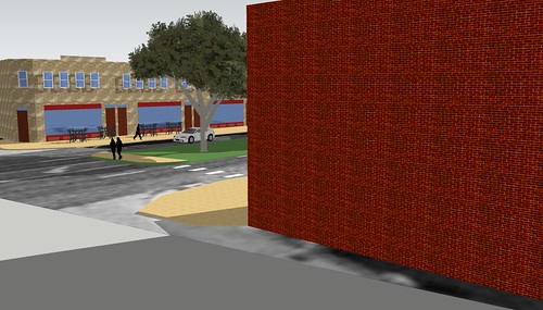
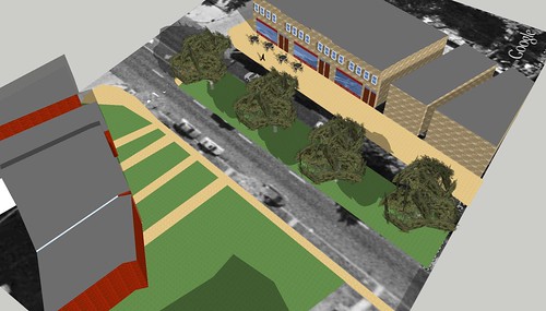
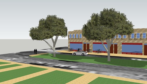
What is important for re-establishing a neighborhood business district today is the presence of not just corner commercial units (which have often been converted to residential-only anyway) but also mid-block mixed use buildings. These are the buildings that encourage people to continue their journey afoot, convinced that more such beacons of commerce exist farther that way.

Chippewa doesn't have a ton of these, but, as the picture shows above, they're there.


Here's a nice corner commercial building at Chippewa and Ohio. After a little renovation, this could really shine.


Here's a unique corner commercial unit just a block west of those previously shown. Again, a bit of a storefront makeover would go a long way in sprucing up this handsome building (although it might be sad to see those kitchy and in no way appropriate Georgian-style ogee arches over the door disappear).

Hopefully, I'll be able to put together a little map of available properties, since the city seems to have a picture of nearly everything on Chippewa. It has a great stock of both residential and mixed use properties that are simply a little worse for the wear. I'd hate to see it get to the point where more properties are demolished. There's already a large vacant lot in the district as well as an autocentric corner at Compton/Chippewa. Luckily, though, this area is now in the Gravois-Jefferson Historic Streetcar Suburb National Register District, which means that any owner seeking a demolition permit must go through Cultural Resources and the Preservation Board first.

With any luck, this old business district could reconnect with the cluster at Chippewa/Broadway/Jefferson, which has been autocentricized, but not, perhaps, to the point of death. A fine row of commercial buildings, the subject of much controversy due to Alderman Schmid's liquor license restrictions, sits on the east side of Broadway just south of Chippewa awaiting full occupancy.

Sunday, July 19, 2009

The St. Louis Business District: Walkable, but is it Walked?

Having just returned from Pittsburgh, I was absolutely blown away by their mile-after-mile of not-just-active but vibrant business districts in every corner of the city. Pittsburgh's Squirrel Hill commercial district, or South Side on Carson Street, or Liberty in Bloomfield, etc. are not just walkable--they're walked!

Pittsburgh has about 310,000 residents at last Census count. Its metropolitan region has 2.4 million. St. Louis has about 355,000 residents with an area of around 3 million.


So what gives? Without delving into the two cities' respective histories and demographies, I want to know what your ideas are for increasing St. Louis's pedestrian friendliness with the ultimate goal of increasing the number of pedestrians. I know crime, racial tensions, weather, overly wide streets, lack of pedestrian amenities, lack of vital public spaces and other factors hold St. Louis down to a degree that Pittsburgh just does not.


But it is amazing to me that a city of St. Louis's size, compared to Pittsburgh, has only the Loop as a traditional urban business district where one can walk several blocks and see dozens of other individuals walking with them.


A lot of St. Louis's problems seem to rest in its leaders and residents' belief in the mantra: if you provide parking, they will come. Yet, as we can see with the popularity of the Delmar Loop, it's the goal of having a commercial street with high foot traffic that really draws people. The people-watching appeal is undeniable when walking through any commercial area--whether a mall, the Loop, or Carson Street in Pittsburgh. Yet St. Louis's leaders (and even residents, often) are complicit in providing plentiful parking spaces.


New Orleans's Magazine Street is another great example. In its six miles, most of it retail and mixed use buildings, there are no parking garages. The street is active and heavily foot-trafficked.


St. Louisans also often cite a lack of parking as the reason for a particular business's failure. Yet is the equation that simple? Might that driving customer have struggled to find a space (what--2 blocks away tops?) if that same place had an awesome sign out front that drew them in; had amazing customer service or a unique product; had several stores and restaurants nearby to make the parking experience worthwhile? Better yet, what if more residents surrounding the establishment had walked from home?


Having visited and lived in cities of similar size to St. Louis--Pittsburgh and New Orleans--I have to say that this is one of St. Louis's greatest downfalls and one of its biggest detractors from claiming urbanism. There is a pronounced dearth of healthy business districts that are not only walkable (Manchester, Macklind, South Grand) but also regularly walked. Luckily, this seems to be slowly changing as some commercial areas become more popular and see new business openings (see previous three examples).


Yet the model of reinvigoration of a St. Louis business district always seems contingent on developing "destinations" out of individual buildings rather than marketing the whole district as a commodity. This leads to adjacent parking lots and the notion that a business district must "graduate" to walkability only after being deemed a "parkable" destination.


I have much hope for Cherokee Street as St. Louis's first and foremost example of relatively unbroken, walkable, and walked urbanism outside the Loop and Euclid in the CWE. With the Great Streets Initiative, South Grand could finally reach the critical mass of pedestrians as well. And North 14th Street in Old North at least sports the two blocks with an almost intact street wall.


Where do you fall on this discussion? Should we allow parking lots for the burgeoning district to reel people in, then allow demand to the fill those parking lots in with buildings? Or should we aggressively market existing business districts as urban places and significantly restrict all but on-street parking in order to encourage a) people to park farther away and therefore walk farther, b) people to simply walk to the district if they are within, say, one half mile distance, and c) people to take mass transit to arrive at these business districts?

Saturday, July 18, 2009

Northside Project Community Benefits Alliance Includes Provision to Modify Preservation Review

The citizens of the wards affected by Paul McKee, Jr.'s Northside Regeneration project have drafted an innovative document that, if adopted, would certainly alter how the project proceeds and what it does for current residents. Read the Community Benefits Alliance's work here on their website.

Of particular interest to me is the call for residents--not the Building Division--to review proposals for demolitions in all of north St. Louis (not just the project area, even).

Neighborhood Control of Preservation and Demolition: We propose an immediate moratorium on demolition north of Delmar, and meaningful neighborhood control of preservation and demolition. In order to preserve the valuable housing stock and architectural heritage north of Delmar, we believe that all of north city should be put under a revised form of Preservation Review, where proposed demolitions would need to be approved by the Neighborhood Development Advisory Board prior to review by the St. Louis Preservation Review Board. In addition, we expect any emergency demolitions be approved by the Neighborhood Advisory Board prior to approval by the Building Division, to prevent a developer from using this known loophole in preservation planning to demolish salvageable historic buildings which meet community standards for rehabilitation. This will preserve the community’s ability to access the State Historic Tax Credit program as an engine for economic development.

Emergency demolition permits are the easiest way to bypass preservation legislation in the city. Simply let your building precipitously decay (removing boards from windows helps) and watch as the city grants you an emergency demolition permit.


But a lot of the North Side is not in either a local historic district or a National Register District. North Side wards are also basically missing from Preservation Review, a process that ensures each demolition permit is reviewed by the Cultural Resources Office instead of simply going straight through to the Building Division, who almost always approves permits.


This bold suggestion of having the community review what of their building stock is important to them is innovative. It may not be airtight itself (some people, especially without architectural backgrounds, tend to unilaterally favor new construction at the expense of old). But the language in the CBA is still a bold step in the right direction of instituting citywide Preservation Review.


It's unbelievable to me that a city in 2009 would allow for a huge North Side warehouse to be dismantled (for a parking lot? This is getting beyond old.) Yet this demolition sailed through without so much as a notice at a grocery store.


This is simply unacceptable. The NorthSide CBA is one of the only public voices I have heard that has proposed this "radical" solution to our city falling further into an unwalkable, uninteresting, semi-rural haven for the automobile.

Friday, July 17, 2009

Back in Town


I've returned from Pittsburgh armed to the teeth with lessons in urban design, preservation, civic engagement, localism, etc.

And so, despite being in the thick of thesis-writing, this blog should return to its normal schedule soon. I've taken a liking to Tumblr, though, and will probably continue to maintain that site as my interim blog between posts here at Dotage.


Tuesday, July 7, 2009

Apologies and Tumblr

An update on me: I'm writing a thesis right now. I'm taking two summer classes. I'm headed to Pittsburgh for a couple days starting Friday. In short, blogging time is being sacrificed left and right.

In order that I still might provide quick, breezy updates, I have opened a Tumblr account.

To me, Tumblr is sort of a cross between a Blogger/Wordpress and Twitter. It's super easy to do quickfire posts. This is what I need right now.

So, for mini-updates, please see my presently unadorned Tumblr site:

http://stldotage.tumblr.com/

Wednesday, July 1, 2009

354,361

That's the number of people St. Louis was said to have by the U.S. Census Bureau's July 1, 2008 estimates. This is down from 355,663 in July 1, 2007.

But as today's Post-Dispatch article mentions, the city has successfully challenged annual Census estimates since 2003, all having been revised upward by several thousand people.

Will Mayor Slay challenge this number? What do you think it will be revised to? What's your anecdotal sense of the state of growth/decline in the city? How important is a higher population for the City of St. Louis?

Fashion STL Style!

Fashion STL Style!
St. Louis Gives You the Shirt Off of Its Own Back!

Next American City

Next American City
Your Go-To Source for Urban Affairs

Join the StreetsBlog Network!

Join the StreetsBlog Network!
Your Source for Livable Streets

Trust in Rust!

Trust in Rust!
News from the Rustbelt

Dotage St. Louis -- Blogging the St. Louis Built Environment Since 2008

Topics: Historic Preservation, Politics and Government, Development, Architecture, Urban Planning, Urban Design, Local Business, Crime and Safety, Neighborhoods, and Anything Else Relating to Making St. Louis a Better City!