Search This Blog (A.K.A. "I Dote On...")

Thursday, April 29, 2010

Archgrounds Design Competition: Its Participants and Their Design Philosophies

St. Louis Energized has a nice write-up on last night's "Meet the Designers" session for the City Arch River 2015 competition, which was held at the Roberts Orpheum Theater downtown.

The author summarized the five teams still vying in the competition along with their design philosophies, presented in brief, 15-minute presentations in which no questions were allowed from the audience.


    • The Behnisch Team focused on the "needs of people" (stating that a "good city is a city with a human dimension"), as well as the built environment by calling for the Memorial to become an "active catalyst for urban cohesion." 

    • The approach of the MVVA Team seems primarily landscape-oriented, stressing that landscape (1) accommodates a humane scale, (2) provides continuity, and (3) is affordable.

    • The PWP Landscape Architecture, Foster + Partners, Civitas team (whose representative personally knew both Eero Saarinen and Dan Kiley) advocated "subtle and respectful" changes that, while transformative, are so natural that they're barely noticeable to the majority of the public.

    • The SOM, Hargreaves, BIG team stressed "making places for people" (places that are "alive" every day), as well as tying design ideas into a community's bold, long-range plans to "create economic vitality."

    • The Weiss/Manfredi team referred to three primary design categories, titled "Icon and Setting," "Connections," and "Layering Programs." The interesting facet of this team's approach was an affinity for embracing barriers (such as highways), by turning them into connections and "capturing their energy" without actually removing them.

Reading Live Tweets from the event, as well as the above summary in addition to others, I must say I am a bit worried that the most obvious problem of the Archgrounds may not receive its due attention and the needed ultimate solution. Interstate 70 from the Poplar Street Bridge all the way to the New Mississippi River Bridge is the obvious problem. Wholesale removal is the needed ultimate solution. I-70 will be re-routed upon completion of the new bridge anyhow, and connecting the Arch to neighborhoods should take this very symbolic and helpful step. An open doorway with a removed I-70 will literally allow surrounding neighborhoods a brand new view of, and connection to, the Arch. I fully endorse this concept and support City to River's effort to make this solution part of any proposal to redevelop the Archgrounds.

It's important here to note the ramifications of the removal of I-70. Does a removed I-70 promise instant development along the old interstate right-of-way? Of course not. The land where the highway once sat, upon removal, might sit as a landscape boulevard with few buildings of note for quite some years. Almost certainly, the entire 1.4 mile stretch of the new Memorial Drive that would take the place of the old I-70 will not be filled with urban-formatted buildings by the time the design competition's winning proposal is completed in 2015. This sounds very pessimistic, right? It seems to defeat the purpose of undertaking something so exciting and momentous as giving a stretch of road back to the city and its people rather than to speeding vehicles. After all, if the "new" Memorial Drive is in fact just a landscaped but largely lifeless boulevard in 2015, City to River will have failed and all skeptics of the City to River concept will have been vindicated, right?

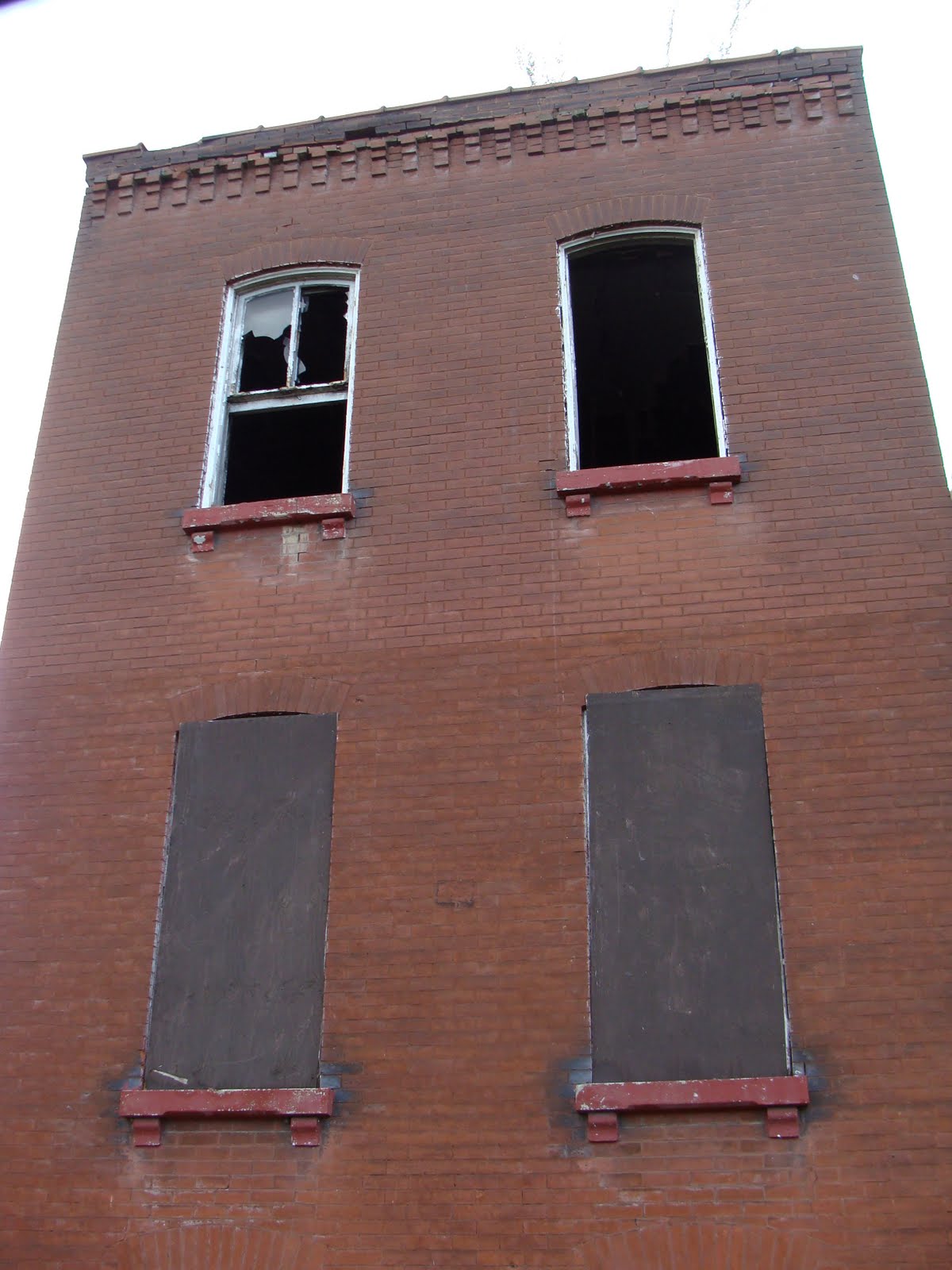
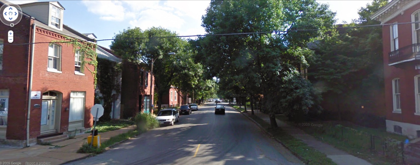
Wrong (at least in my opinion!). An empty, but pedestrian-oriented, Memorial Drive will create an opportunity that does not presently exist--development could then locate on the periphery of the Archgrounds and create a "spine" of activity linking neighborhoods to the north (Carr Square, Columbus Square, Neighborhood Gardens, the Bottle District, Laclede's Landing, the Near North Riverfront, etc.) to their downtown. The present mess made by I-70 as it slices through a once functional grid is reason enough to abandon this alignment. Pedestrians and vehicles alike could safely maneuver a reconstructed street whereas I-70 today merely creates confusion and barriers.

As far as the new Memorial Drive proposed by City to River, and the possibility that it might not attract builders to populate the newly developable parcels, I point you here:


The year is 1951 and these jets are flying just northeast of today's site of the Gateway Arch, which was completed in 1965. It was in 1947 that Eero Saarinen's Gateway Arch concept won the international design competition. In anticipation of the competition, most of the dozens of square blocks containing an antebellum manufacturing district were cleared in the early 1940s. So, if all building were gone from the site by 1942, and the site was a surface parking lot, as seen above, by 1951, then for at least 14 years the site of the memorial was not truly public. Considering that the Jefferson National Expansion Memorial didn't even officially open to the public until 1967, we see here that the same competition that netted the ingenious Arch design caused a 40-block swath of the city to go out of commission for over a decade. (I don't count parking lots, even publicly owned and maintained ones, as public places). If this is true, then we should allow for the same grace period for a new Memorial Drive in anticipation of its own greatness. That doesn't mean we as a city shouldn't aggressively market this newly available land or that the design competition won't cause an increase in demand for these blocks. It's just a plea for skeptics to realize that sometimes, as the old moniker goes, great things come to those who wait. The old I-70 alignment's erasure will have been more than justified if, in ten or twenty years, a new Memorial Drive is beginning to kick and thrive.

Now back to the buzz over the five teams. Not having seen the actual presentation, it's difficult to pass any substantive judgment on their concepts. As written up by St. Louis Energized, I despise the idea of Weiss/Manfredi. St. Louisans have had to limbo around barriers long enough! There are no LCD screens; no garish light displays; no amount of lush greenery or ivy screens; there is no sculpture large enough; no pedestrian bridge crazy enough; no public-space-beneath-the-interstate-avant-gardeism impressive enough; no single or multiple solutions to screening and/or incorporating deadening infrastructure into the redesign. While this is surely an interesting proposal from a conceptual standpoint, the design will be inhumane, no matter how flashy it is, if it values "concepts" over people and access. So I am turned off by this description of their philosophy entirely.

I am surprised at the suggestion of the PWP, et al. crew to make changes that are "barely noticeable" to the public. We must keep in mind that the Archgrounds are quite large and that, preserving the landscape largely as is requires that activation efforts on all edges of the Memorial be stepped up considerably. People need to be able to appreciate the passive landscaping of the Archgrounds, or otherwise the respect for its presence in this competition is somewhat ill-founded.

Many of the teams correctly identified that the Arch redevelopment, ultimately, should cater to people. This is a great though often overlooked observation--especially as traffic engineers crunch numbers and determine that the needs of cars somehow take precedence over the needs of people in what should rightfully be the region's greatest civic and public space.

I would not mind a design proposal that dedicated most of its time to addressing issues presented by having an interstate as a neighbor. Remove I-70 (do not tunnel it and merely hide the problem for just four blocks). Incorporate retail or tourist-supporting services within the arches of the Eads Bridge piers. Redesign parking for the site so that the northern edge of the Memorial visually and physically connects with Laclede's Landing and points north. Landscape the riverfront itself--certainly it is one the nation's most barren urban riverfronts today. Have water taxis or some sort of pedestrian bridge to connect to East St. Louis; see to it that the East St. Louis Riverfront indeed becomes home to the world's largest architecture museum, as proposed and sought by the St. Louis Building Arts Foundation. Enhance pedestrian connections to Chouteau's Landing; allocate some funding to the Chouteau Lake and Greenway to jumpstart that project. And so on and so forth. All of these interventions would make the Arch more of a "place" situated in a context--and little would have to be altered within the existing landscape other than its worst features currently, the parking garage and floodwalls.

Despite my earlier comments, I am absolutely thrilled by the excitement over this competition. Its outcome and winning proposal could truly lift the spirits of our city and give us all a place we're proud of. The Arch, downtown, the Mississippi River, and the city deserve it!

Tuesday, April 27, 2010

Will a Gate District Landmark Soon be Reborn?

The Garavaglia Grocery complex at Lafayette and Nebraska in the Gate District is something of a faded landmark. It is shown below, courtesy of Google Streetview:


Why do I ask if it's soon to be rescued from its vacancy?

Well, on March 31, 2010, the Garavaglia buildings were listed on the National Register of Historic Places. The nomination contains some excellent photography of the interior of the building, so I would recommend checking that out!

Why would the owner, listed by the city as Garavaglia Quality Foods, have sought historic status? Could it be to renovate the building and take advantage of the state historic rehabilitation tax credits? Possibly.

Could work begin soon on this Gate District landmark? Anyone have the scoop?

Monday, April 26, 2010

Metro Can Bring Us a United Cherokee, from Lemp to Grand

Post-Proposition M in November 2008, Metro's service reductions would litter streetscapes everywhere with plastic bags placed over bus stops that, we now all know too well, read: "We Regret Due to Lack of Funding Service to this Stop has been Suspended".

Sadly, St. Louis's most exciting business district--Cherokee Street--was among those areas without transit service. Vanishing St. Louis observed at the time that "Downtown St. Louis [would] be without street level transit for the first time since before the Civil War". Likewise, Cherokee Street, the South Side's downtown, would lose its historic transit service as well, present since the 1890s in the form of an electric streetcar and later, of course, as a bus.

Today, the #73 Carondelet bus serves the eastern portion of Cherokee, between Lemp and Jefferson, which is known as Antique Row. Yet Cherokee between Jefferson and Grand is without service. This is unacceptable. All great cities, and by extension all great streets, should offer the opportunity to live without a vehicle. Living on or around Cherokee Street west of Jefferson is now made more difficult without direct transit service. Even a relatively short walk to the nearest bus stop can make a commute a headache. Living in the heart of the Cherokee District, say at Nebraska Avenue, one would have to walk six blocks to the Jefferson bus (#11 Chippewa), more than seven blocks to the Gravois bus (#10 Gravois-Lindell); nine blocks to the Grand bus (#70 Grand); and four elongated blocks to the Arsenal bus (#30 Soulard). This is not an impossible journey in any of these directions; just frustrating and inconvenient. We must press for a United Cherokee!


Image borrowed from WeLoveCherokee and edited by me.

Plus, currently, Cherokee Street and Grand South Grand seem miles and eons apart. Mostly this is due to the fact that Gravois is such a wide street with high-speed traffic. Transit has a way of healing unforgiving urban environments. If I lived in Old North St. Louis, for example, I'd likely never choose to walk the roughly one and half mile distance between Crown Candy and downtown--I'd take the bus. Without this bus service, Old North would feel like a distant planet from relatively nearby downtown--and a much less attractive place to live. Luckily, though, the #30 Soulard can get me to City Hall (to apply for a building permit to renovate my row house?) in less than 10 minutes.

The #73 Carondelet should therefore cross Gravois and connect with the city's best used bus line--the #70 Grand. At that point, it would not be a stretch for St. Louis University students (and other people who live along the long and populous Grand Boulevard) to take the #70 to the "Cherokee bus" and explore the city's most bustling commercial district.

People living in Benton Park along the #73 could then use just one bus line to get to a grocery store (the South Grand Schnucks, where an influx of shoppers might finally force the management to substantially refurbish that location. That's enough of an incentive, huh?).

 The current route of the #73 Carondelet. Can you even spot the pitifully short leg on Cherokee Street?

Now, would I love this bus to become a streetcar? Of course. But let's get the transit service restored first and see what else we can do later. Who's with me? Let's make sure Metro takes its funds from the Prop A victory and reestablishes a bus line down Cherokee in its 2010 Restoration plan!

Please do any and all of the following if you support a United Cherokee, from Lemp to Grand!

Email Metro officials: restoration2010@metrostlouis.org (thanks, Paul!)


Comment on Next Stop, Metro's transit blog, indicating your support for a United Cherokee.

Contact the two alderman who could have sway over such decisions: 9th Ward Alderman Ken Ortmann and 20th Ward Alderman Craig Schmid:

Ken Ortmann
(314) 622-3287
(314) 776-0161 Additional Phone

Email here.
Craig Schmid
(314) 622-3287
Email here.
 
Tweet Metro or its orderlies (note: term of endearment) with your support!
 
Official Twitter feed for Metro: http://twitter.com/STLMetro
 
Twitter feed for Courtney Sloger, Next Stop blogger and Metro Social Media Maven: http://twitter.com/STLTransit
 
Facebook Metro and leave a wall post indicating your support for a United Cherokee. Link to official Facebook page.
 
Thanks, all, and thanks to Cherokee Street News for giving me this idea!

Sunday, April 25, 2010

Oak Hill Area of Tower Grove South - Now Historic

I am jumping the gun just a bit, as Monday's Preservation Board meeting will see this National Register of Historic Places nomination approved, but I'm okay with that. The beautiful Oak Hill sub-neighborhood of Tower Grove South will soon be officially designated as historic. Some might scratch their heads and say, "well of course this neighborhood is historic," but in the eyes of the federal and state government, who issue lucrative historic rehabilitation tax credits, your property must be "officially" designated historic either individually or within an approved district.

Oak Hill will be the city's latest historic district. All over St. Louis, these fairly sizable districts are opening new parts of the city to investment in historic properties. Old McRee Town, Grand-Bates, St. Cecelia, the old Wellston shopping district along Martin Luther King, Marine Villa, and more have all been added to the Register recently. Oak Hill is 32 blocks containing 1,261 contributing buildings. Here is a map of the proposed Oak Hill district, from the Cultural Resources Office staff report for the April Preservation Board meeting:


The Oak Hill district extends from Gustine on the west to Portis Avenue on the east; Arsenal on the north to an irregular boundary on the south that includes Humphrey and Utah.

It is notable, to me, for its concentration of historic frame structures mixed in with classic red brick apartment buildings. It also includes the revitalizing Morgan Ford Strip, also known as Skinnytown, which may be the most immediate beneficiary of the historic rehabilitation tax credit. West of Morgan Ford, the architectural diversity increases, with some lightly detailed Queen Anne buildings and even some small Second Empire buildings. Below is a picture of Juniata at Alfred, one block west of Morgan Ford (courtesy of Google Streetview):


A brown brick four-family with St. Louis-style white baker's brick adorns the corner. It neighbors a nice red brick simply-detailed front-entry vernacular building. Next door to that are two Second Empire micro-mansions, followed by a series of simple frame front gable structures. There are a lot of styles working over here. When you throw in lushly planted streetscapes, the result is a beautiful, if understated urban environment.

I'm happy to see Oak Hill gets it due attention!

Cultural Resources Office Recommends Denial of Demolition Permits on Chouteau

 UPDATE (4/27/10): The Preservation Board has denied the appeal for demolition of the buildings shown below! Great news!

The Cultural Resources Office (CRO) is encouraging the Preservation Board to deny the appeal of owner Crown 40, Inc., a convenience store operator, who wishes to tear down a row of four buildings on Chouteau.


The CRO staff report notes that Crown 40 seeks to demolish the four buildings to keep them as "grassy lots" in lieu of future development. Thankfully, the CRO does not feel that this "plan" constitutes a true development plan for the sake of the preservation review ordinance. They note, rightly, that none of the Chouteau buildings individually is significant, but, as a group, they make an important contribution to Chouteau's urban street wall.

Hopefully, the Preservation Board will heed to advice of the CRO and deny what would be a senseless plan to demolish four buildings just to create vacant lots. The Board meets Monday, April 26, at 4pm. The location is 1015 Locust, Suite 1200.

The CRO report also includes several buildings--and a new historic district in Tower Grove South called Oak Hill--that will be added to the National Register of Historic Places.

Friday, April 23, 2010

Update: More Information on Hyde Park Rehabs

This blog recently reported on 15 building permits for renovations in Hyde Park, all received in March 2010. All parcels in question are owned by the Eliot School, LP. The Eliot School, LP shares the same registered address as the Irving School, LP, owners of the now renovated Irving School. To view photos of that renovation, I point you to Michael Allen's Flickr page.

Here is a picture of the historic school prior to renovation, also courtesy of Michael Allen via Ecology of Absence:


Eliot School, LP will be rehabbing the Eliot School as well, located at 4218 Grove Street in the Fairground neighborhood, just outside of Hyde Park. The Board of Education is still the owner, but the city's development website says the former school will be converted into low-income housing. The city lists the developer as Better Living Communities--a project of Bethlehem Lutheran Church, which completed a development of several new townhomes on Salisbury called Salisbury Park I in the early 2000s, among other projects.

Pictured below, courtesy of the City of St. Louis, is the old Eliot School:


Better Living Communities has put a lot of effort into stabilizing and bettering its surrounding neighborhoods. Bravo to them. It's a thrill to see so much of Hyde Park's heritage rescued all at once.

I wonder if they had anything to do with Salisbury Street's new sidewalks and nifty acorn street lamps?

Above, a nicely redone streetscape along Salisbury. The Salisbury Park development is located on the south (right) side of the street staring down some historic beauties on the north (left) side.

This is all such great news! I cannot wait to check out Hyde Park the next time I'm in town.

Another Gas Station on Chouteau?

Gas station, then-under construction, now complete, at Jefferson and Clark

Quick note: the reason for this month's proposed demolitions on Chouteau Avenue in the Gate District is a familiar, though saddening one: to make way for a gas station. Michael Allen of Ecology of Absence has made the connection I did not: that applicant Crown 40 is related to the convenience store chain of the same name. I should have known.

The loss of any urban buildings to a gas station is unacceptable. With a new gas station located mere blocks away on Jefferson just north of I-64/40 (its construction site is shown above), this proposal is ludicrous.

I must urge you to testify at the Preservation Board meeting if you are available. Do not stand by to watch an urban design disaster take place. Vote, with your testimony, for a city built for pedestrians, not automobiles exclusively.

Monday, April 26, 2010 at 4pm
1015 Locust
12th Floor Conference Room

If you cannot make it in person, please send your testimony to BufordA@stlouiscity.com.

Thursday, April 22, 2010

Hyde Park's "Number Streets" See a Flurry of Renovations in March

 In the month of March, the Hyde Park neighborhood saw over $4.8 million in building permit activity. Almost all of the permits are in Hyde Park's western half, in the "number streets" from 19th up to 25th.

Included in the mix of units with permits for substantial rehabilitation are:

--two single-family homes
--ten two-family homes
--three four-family homes.

The owner of the parcels in question is Eliot School, LP.

Below is a list of the addresses, with whatever pictures I could scrounge up from the city's website. UPDATE (4/26/10): Chris Naffziger of St. Louis Patina was kind enough to get some photographs of addresses I couldn't get pictures for online! Thanks, Chris!

4034 N. 23rd Street (courtesy of Chris Naffziger at St. Louis Patina)

4008 25th Street

3606-08 19th Street (at center)


3613 19th Street

3915-17 19th Street


3942-44 N. 20th Street (courtesy of Chris Naffziger at St. Louis Patina)

3918 N. 21st Street (courtesy of Chris Naffziger at St. Louis Patina)


3931 N. 21st Street (courtesy of Chris Naffziger at St. Louis Patina)

4031 N. 22nd Street

3906 N. 23rd Street


4013 N. 23rd Street (courtesy of Chris Naffziger at St. Louis Patina)

3610-12 25th Street (at left)

3933 25th Street (what a gem!?)

4009 25th Street

1918 Angelica (courtesy of Chris Naffziger at St. Louis Patina)
I am absolutely overjoyed to see so many venerable Hyde Park structures getting rehabilitated! Hyde Park is my favorite North Side neighborhood and among my favorites in the city. Concentrated rehabilitation is a great strategy for stabilizing this portion of the neighborhood. Way to go! Anyone care to fill in the photographic gaps for me? I'd credit your work and possibly buy you lunch at Cornerstone Cafe in Hyde Park the next time I'm in town!

Wednesday, April 21, 2010

Op Art Brickwork in Bevo, Dutchtown

Does anyone know what type of brick/brickwork this is? I call it "Op Art" because, up close, it almost disorients the eye with its stylistic patterns.

Bevo, at Neosho and Morgan Ford:


And then one of my favorite little houses in the city, on Kingsland Court at Hydraulic in Dutchtown West:


The home above, in particular, is a must-see. What are these eye-popping bricks? Are they just cleverly arranged buff-colored brick?

Tuesday, April 20, 2010

Kosciusko Historic Building Now...History?

I regularly follow Mark Groth's St. Louis City Talk blog. I especially love his neighborhood profiles. He recently covered the large industrial "neighborhood" known as Kosciusko.

Readers of this blog likely know that Kosciusko was not always a large riverside industrial park. It was once an urban neighborhood successfully woven into the urban fabric. Prior to its clearance via urban renewal in the late 1950s and early 1960s, this neighborhood was part of the greater Soulard area and looked the part--with red brick row houses and commercial buildings.

While stories and pictures of other St. Louis neighborhoods demolished under the auspices of urban renewal exist in plentiful fashion (see DeSoto-Carr and Mill Creek Valley), there are very few available historic photographs of Kosciusko. (Click here to see a photography thread via Skyscraper Page of St. Louis urban renewal neighborhoods, including DeSoto-Carr, before the wrecking ball. Warning: not for the faint of heart).

I have found exactly one actual photograph of Kosciusko, via the History of Urban Renewal planning document that Urban Review St. Louis posted on in January of 2009. It shows two buildings in the historic neighborhood that were felled for a new one.


Not the best quality, huh?

Of course, there's always the 1875 Compton and Dry Atlas to consult. These aren't photographs, yet they are meticulous bird's eye view drawings of the city just prior to its heyday.

Here is a view of Kosciusko's northern half, bustling at the beginning of the last quarter of the 19th century.


In this view, the top of the photo is facing west and the right side of the photo is facing north, towards downtown. Miller Street still exists today, while the commercial street with the notably taller buildings at the top of the photo is Carondelet Avenue, today's South Broadway.

But the portion of Kosciusko I'm interested in is farther south. In fact, I'm talking about a specific address: 107 Victor, at Kosciusko Street. The building(s) there appeared on the Preservation Board Agenda in September 2009, but were removed before the date of the actual meeting under unexplained circumstances. It is possible that the Cultural Resources Office granted a demolition permit after some sort of concessions were made. Groth noted in his post that while photographing in Kosciusko, he was stopped by security guards who told him one of the historic buildings he was seeking was recently demolished. I can only presume that the guards were referring to 107 Victor, pictured below.


107 Victor looks to be one of the last remaining 19th century buildings in Kosciusko. It also has a very interesting outbuilding that makes me speculate a bit as to its origins. It is shown below:


This type of outbuilding is found all over New Orleans' older Creole neighborhoods: a small structure with a flounder-shaped roof attached perpendicularly to a main building. Almost all have side galleries as well, just as this one does.

This is an aerial view of the French Quarter in New Orleans with such buildings highlighted.


The fact that 107 Victor has this fairly well preserved Creole-styled outbuilding made me wonder if the Italianate main building was built afterward, with the original main structure having been torn down. Then I thought it wise to again consult Compton and Dry for some clues. If the outbuilding was there as of 1875, then we can assume this is likely an old Creole style building typical of the Soulard and Kosciusko neighborhoods at the time.


That's a zoomed-in shot of 107 Victor at Kosciusko Street. Behind it appears to be a Creole-styled outbuilding, though admittedly its view is obfuscated by the main building. As for the main structure itself, it's definitely not the same as what stands (or what stood) at 107 Victor today. The current structure is three stories. But wait...do you notice the elongated center window? Today's structure has that same feature:


Notice the elongated central window on this structure as well? The third story--along with its Italianate-style cornice--could have easily been added onto the building after 1875.

Let me again repeat: I have no idea if this building and its outbuilding were actually demolished. As they did not show up in Mark Groth's blog post, and as security guards informed him a building had been recently demolished, I had to assume it was 107 Victor, which was on the Preservation Board Agenda previously. Could anyone confirm whether these buildings are still extant? It's a short hop away from Soulard and on public roads.

What's the point of all of this anyway? Part of it is just documentation of the history and architecture of a nearly vanquished part of the city. The other part of me is hoping we don't lose all traces of our heritage as the nation's fourth largest city, when we had residential neighborhoods circling downtown without a single break in the street wall. Buildings, people, everywhere. Kosciusko will likely never be anything other than what it is now: an industrial park. Still, I think the old buildings it retains still have value despite their isolation and removal from their historic context. At least one historic Kosciusko structure is receiving good treatment--the Hager Hinge Company building right down the street at 139 Victor. It's a historic St. Louis vernacular building constructed in the early 1870s that has been listed on the National Register of Historic Places.


Have we lost the piece of history at 107 Victor, though? Most would say, "who cares?" but I'm still curious.

UPDATE (3:20pm): Reader Hilary has driven by the site and confirmed that 107 Victor is gone. Thanks Hilary!

Monday, April 19, 2010

Conceding Tucker Boulevard to Blandness

St. Louis doesn't have a system of comprehensive planning. Thus it surprises few observers in the urbanist community when an individual developer floats his or her project without regard to its surroundings.

Today comes (overall, great) news that the AFL-CIO Trust will commit $108 million to two downtown development projects--the Laurel Building (also known as the Dillard's Building) and the Park Pacific building at 13th and Olive.

So what's the bad news? Tucker Boulevard--a street whose grandiose size might confuse visitors into thinking it's St. Louis's "Main Street"--is being dedicated as the parking garage elevation for the Park Pacific building's redevelopment. A tiny rendering is shown in the article:


Some might say, in autocentric St. Louis, it's necessary to have dedicated parking (it's probably also tied to financing, in some way). Truthfully, I don't dispute that some parking is needed to redevelop this building. However, the above rendering is unacceptable for Tucker Boulevard if this street is ever to become active, urban, and attractive.

The City of St. Louis recently constructed a monster of a parking garage at the northeast corner of Tucker and Clark. See a Google Streetview capture of the garage, without its retail bays added as of yet, below:


I commend the city for attempting to make a statement with a parking garage rather than constructing a series of bare concrete decks (sort of like the kind shown in the Park Pacific rendering, on the north side of the site). However, parking is in severe oversupply downtown when all off-street spaces are accounted for. And the Tucker garage shown here at Clark Street is not even attached to any one project--it's a municipal garage. If every downtown redevelopment project includes its own dedicated parking garage with more than one space per visitor or resident, not to mention separate municipal garages, opportunity for a true urban environment is squandered. Transit is disincentivized as driving becomes easier. Every new parking space drives the cost of parking down, and as parking becomes cheaper, it becomes the better option. Convenient parking reduces walking times and distances, cutting down the chances that a pedestrian will linger downtown and walk around to discover its retail, restaurant, and entertainment offerings.

But this post is not even really a statement against downtown St. Louis's parking oversupply, primarily. It's about poor urban design on one of St. Louis's major downtown streets. Across from the new municipal garage at Tucker and Clark is a surface parking lot serving City Hall. Just north of the Gateway Mall blocks are the Park Pacific site, a pair of deadening and severe mid-rises, a woefully underused parcel that a one-story US Bank branch sits on, and several other gaps as well. Filling in the Park Pacific site with an unsightly parking garage relegates Tucker to third class status as an urban boulevard.

I wrote on a previous post in agreement with a statement that said people desire to live in cohesive urban environments. That means that few people will be proud of a place that is beautiful in one area (Washington Avenue), while dreary just a block or two over (Tucker Boulevard). We must reposition our downtown so that its dead zones are not so apparent.

Park Pacific developers should include a four-story mixed-use building that wraps Tucker, Pine, and Olive on all sides. Parking could be hidden in the core of this building. Street-level retail is not enough to mitigate the damage of exposed parking decks on a street with as many issues as Tucker has already. Here is an example of what I mean, from Baltimore's Fells Point neighborhood.


This new mixed-use building may not be flashy, but it's a nicely scaled urban building. Do you see its attached parking garage? I don't.

Walk too fast and you might even miss the spot to pull in to its large dedicated parking garage. It's located behind the building, on the inside and invisible to the public portion of the block.


Park Pacific should not proceed with plans that would concede Tucker to blandness. It's a visually important street for St. Louis.

Tucker--once 12th Street--has an important legacy that should be respected. 12th Street was once symbolic enough of St. Louis for postcard representation.


Especially as St. Louis bids for the Democratic National Convention and wishes to play host to tens of thousands of visitors from across the nation in 2012, we should be cleaning up the face of our region--downtown St. Louis--not further scarring it.

Saturday, April 17, 2010

Fox Park Neighborhood Exploring a Local Historic District Expansion

The Fox Park neighborhood is pursuing an expansion of their local historic district to include portions of the neighborhood south of Victor. (Click here to see blogger Mark Groth's excellent photos of the neighborhood).


For non-preservation types, a local historic district is a far different animal than a district listed on the National Register of Historic Places. A local historic district comes with a set of rules and regulations for exterior alterations, demolitions, and new construction. Such regulations only apply for qualified renovations in a National Register district, and only if the applicant is seeking tax credits. National Register districts do not, by themselves, prevent demolitions in any way. If a project with federal funding is to impact a National Register property or properties, a process called Section 106 review is triggered which may recommend preservation of a threatened resource or resources. However, even Section 106 cannot in and of itself prevent demolition.

 Local historic districts are often the most effective at dissuading demolitions, as their enabling ordinances contain clear clauses pertaining to how to handle proposed demolitions and alterations. In these cases, the Preservation Board and Cultural Resources Office must defer to the intent of the ordinance. Lafayette Square's local historic district ordinance, for instance, basically prohibits all but the most unavoidable demolitions of any structure constructed in the period of significance. In a city like St. Louis, which lacks a powerful central planning authority, local historic districts are often also a means to introducing urban design standards.

Naturally, then, as local historic districts go much farther than National Register districts (which merely offer rehabilitation incentives), they're also harder to enact.

Fox Park appears to be going through the proper steps to assure that a local historic district expansion is not created without informing residents who will be affected. There have already been three "unofficial" public meetings, not including hearings that are required to introduce such legislation. Plus, on the neighborhood's recently refurbished website, there is a whole section explaining the rules of living within a local historic district. I find this to be a nice gesture towards residents worried about the extra regulations. All neighborhoods inside historic districts should provide this information on their websites.

The write-up even includes examples of "appropriate" and "inappropriate" designs, such as this figure displaying the proper storefront design:

The President's Corner section of the Fox Park Neighborhood News (Spring 2010), penned by Ian Simmons, expresses a point all too often overlooked in St. Louis. Here is a snippet of that text, with a portion bolded by me.

The members of the committee believe that, to continue the growth that has been evident in Fox Park over the last several years, both halves of our neighborhood must be preserved. Both halves contain the same housing stock built by German settlers, and the streets are lined with homes exhibiting beautiful exterior design, architecture, and brickwork; however, the southern half has seen more decay and deterioration, and less restoration. Abandoned, dilapidated homes invite crime into our neighborhood. Designation of a local historic district there would instead encourage rehabilitation of these homes, as owners and investors take advantage of tax credits which would then be available. This would also attract homebuyers to our neighborhood, who are eager to live in a cohesive, historic neighborhood. Expansion of the historic district would also help stabilize and eventually increase property values, protect neighbors’ investments, and encourage business investment in Fox Park. We believe expansion of the existing historic district will benefit not only the southern half of our neighborhood but also Fox Park as a whole. For these reasons, we hope neighbors will embrace this idea.
Simmons hits on a great point: we need cohesive, historic neighborhoods. It's easy to play the parochial card and to say "south of Victor" or "north of Delmar" or "east of Compton" or insert whatever direction and whatever street here, the neighborhood drops off. And we simply accept this as true. All of Fox Park has an interest in the success of just a part of it. That's a great message for the city as a whole. If Fox Park residents can see the importance in picking up a downtrodden section of their neighborhood, why do so many St. Louisans still write off "the State Streets" or "the North Side" or whathaveyou? We should want a cohesive city. That doesn't mean widespread gentrification. Rather, it means paying due attention to the less glamorous areas of our city and realizing our interconnectedness.

Stepping off the soap box, it's good to see yet more of the South Side be added to the expanding list of officially historically designated properties. Hopefully a developer will snatch up this property, located in the expansion area, and return it to use:


Thanks to Corresponding Fractions for the above photograph. I love Fox Park!

Friday, April 16, 2010

The Gift of Greenery: Could Every Block Have a "City Garden"?

Downtown's Citygarden has been very well-received--almost universally so. A two-block segment of the Gateway Mall transformed from passive (read: boring) green space into a magnificent sculpture garden and public space. The metamorphosis came at a cost--$25 million in design and construction alone. The Gateway Foundation picked up the tab.

On the foundation's website, there is a list of projects and initiatives that the foundation has either contributed to or created. You can thank Gateway for St. Louis's three water towers' dramatic lighting, not to mention minor city landmarks like the Arch and Old Courthouse. They helped to renovate Penrose Park in North City, as well. Still, Citygarden is their crowning achievement, their greatest gift yet to the city.

I couldn't help but marvel at the construction process of Citygarden itself. Almost overnight, some worn patches of grass became lush lawns home to new and relatively mature trees. No thin, weakling trees that would take years, perhaps decades, to blossom into proper shade trees--if they survived at all.

I can't help but wonder if the Gateway Foundation could help certain St. Louis neighborhoods overcome a fatal urban design flaw: treelessness. Treelessness need not be taken literally; some blocks in certain neighborhood have quite a few trees, but they're often unhealthy, ill-placed, or simply, there just aren't enough of them.

Trees are so vital to an urban landscape that New York City, to name just one city, has conducted a census of them (the count you ask? 592,130) and a plan to increase their numbers. Of specific interest to me is the "benefits" section explaining why trees are important.

First, this note:  

Benefits are directly linked to tree size. The environmental benefits of trees arise from respiration and transpiration – the biological processes by which trees breathe and absorb water from the environment. Because these processes involve interactions between a tree’s leaves, the environment, and the atmosphere, the benefits increase as trees grow in size. In general, the larger a tree, the more canopy cover and leaf surface area (the total area of the leaf spread) it has.
This list of benefits is so sensible and actionable that I will post each segment in its entirety:

Air Quality Improvement. Leaves absorb gaseous pollutants (carbon dioxide, nitrogen dioxide, and sulfur dioxide), and capture air-borne particles including dirt, dust and soot. Trees also prevent the release of many airborne pollutants by reducing energy generation. Ground level ozone, a contributor to greenhouse gas formation, is reduced through the tree’s ability to lower air temperatures.
ANNUAL BENEFIT VALUE: TO NYC: $5.3 MILLION

Energy Savings. Trees provide shade, reducing the demand for electricity for cooling in the summer. Trees also reduce wind speeds, slowing the loss of heat from interior spaces during the winter. Trees cool the air through the process of transpiration, where moisture is converted to water vapor. An estimate for energy usage for every building in NYC was derived from data on building age, tree shading effects, and local climate. This estimate was drawn with two scenarios—with and without street trees—in order to show the difference in the resulting energy use. Local energy prices were then used to calculate the value of the impact of trees on building energy use.
ANNUAL BENEFIT VALUE TO NYC: $27.8 MILLION


Carbon Dioxide (CO2). Trees indirectly reduce emissions of CO2 from power plants by reducing building energy use. Also as trees grow, they remove CO2 from the atmosphere and store it in woody plant tissue. At the same time, trees release CO2 as they decompose. These releases are subtracted from the total amount of CO2 avoided from power generation and absorbed by tree growth to calculate the net CO2 benefit.
ANNUAL BENEFIT VALUE TO NYC: $754,947

Reducing Stormwater Runoff. Trees help reduce flooding and improve water quality, as runoff flowing over impervious surfaces picks up contaminants including oil and metals. Trees intercept rain on their leaf, branch and stem surfaces and by absorbing water through their roots. The water that trees intercept in NYC each year was calculated using local rainfall data.
ANNUAL BENEFIT VALUE TO NYC: $36 MILLION

Property Value and Other Benefits. Research has shown that homes with a tree in front sell for almost 1 percent more than similar homes without trees. The difference in sale price indirectly reflects the value buyers place on trees and their more intangible benefits, such as aesthetics. This difference was applied to the median New York City home resale price ($537,300) to calculate the total value.
ANNUAL BENEFIT VALUE TO NYC: $52 MILLION

TOTAL ANNUAL BENEFIT TO NYC: $122 MILLION

Clearly, street trees in urban areas are necessary for the city's natural--and built--environments. Yet some of our neighborhoods aren't receiving these benefits.


Let's look at a neighborhood that is among my favorite in the city--Benton Park West. Tree coverage is passable in some places, non-existent in too many others. Check out the 2700 block of Utah Street for a good example of the conditions of the neighborhood:


 What we have here is actually a nice historic blockface typical of the neighborhood. But it looks unnecessarily barren without a proper line of street trees (it also feels barren when you're walking down a sidewalk in summer weather, baking atop unprotected pavement). This should be an in-demand block based on housing stock and location alone. 


Let's look at a street in Benton Park proper, some half mile away from the view we see above. This is the 2900 block of Lemp.


2900 Lemp is not a perfectly planted block by any means, but is similar in most respects to 2700 Utah--historic buildings, just about the same street width and setback, etc. Yet 2900 Lemp is shaded and inviting.


If our lower income neighborhoods have fewer trees, which I believe, in general, is true, then wouldn't planting some mature trees give them a leg up? As demonstrated in the New York City study, trees save households on energy costs and raise property values. Wouldn't it be great if the Gateway Foundation and their Citygarden partner the Missouri Botanical Garden could donate trees to neighborhoods such as Hyde Park and Benton Park West? Again, the trees have to be large to have an effect. Yet a mature tree costs a lot of money. This source says that a locally-available species of tree aged 7-10 years will run you at least $200 a pop. 

Still, a $25 million program focusing on a few neighborhoods that need these trees could see the planting of 125,000 trees if the $200 figure held true (not counting the costs of planting and maintenance). That would be equivalent to 20 percent of the entire city of New York's stock that that city has counted! Passing over some neighborhoods that already have excellent tree coverage (Tower Grove East in parts, St. Louis Hills nearly in its entirety), such a program to establish these citywide "City Gardens" could confer incredible benefits on the recipient neighborhoods (again, see the NYC study). And it should be noted that green projects--tree planting, park renovations, etc.--are among the least controversial projects that a philanthropic foundation like Gateway can put their name to. That said, they're also much needed and do a great service to our city.

Would the Gateway Foundation/Missouri Botanical Garden be willing to plant City Gardens--also known as full streetscapes of mature trees-- across St. Louis?


Thursday, April 15, 2010

A New Life for Soulard's Anheuser Busch Parkings Lots?

Most St. Louisans are well aware that the new management at Anheuser Busch-InBev, or A-B InBev, has been cutting positions at A-B's onetime world headquarters in Soulard. With financial operations moved to New York City, and with much of the company's leadership in either Brazil or Belgium, the Soulard campus is growing quieter. Don't get me wrong. I believe this is pretty bad news for St. Louis and for Soulard.

But there may be a small--or potentially large--up-side to this.

Take a look at Exhibit A: north Soulard, above Sidney Street.


Despite being hemmed in by Interstate 55 on the north and west and an overly-wide and relatively unadorned 7th Street/Broadway on the east, Soulard is a remarkably intact and physically dense neighborhood.

South of Sidney Street, A-B parking lots pervade and largely sully what could be a great connection to one of St. Louis's greatest urban neighborhoods. Living in the shadow of perhaps the world's greatest brewing legacy should be a saleable amenity, but few Soulard homes are within arm's reach of the complex these days.

Exhibit B: south Soulard, below Sidney Street.


Especially towards 7th Street, surface parking takes over an otherwise intact and beautiful neighborhood. Now, with fewer employees and a gradual shift away from the Soulard campus towards other spots across the globe, could the city reclaim these lots? Would A-B InBev hand them off? At least four square blocks are entirely dedicated to surface parking in an area bounded by Lynch Street on the south, 10th Street on the west, Sidney on the north, and 7th on the east. Well, almost entirely.


A nice Soulard home survives on 9th Street with its outbuilding intact (courtesy of Bing Maps). Anyone know the story behind this odd island in the sea of parking?

At any rate, it serves as a good reminder of how to reinvest in this area. We should seek to return these blocks to that successful Soulard scale--one of the city's most intimate.

I wonder what the status of these large lots is now that A-B in Soulard is essentially being downsized. Do surrounding businesses use these lots as well? Would Soulard residents or A-B InBev really miss them?

Tuesday, April 13, 2010

Preliminary April Preservation Board Agenda Includes Demolition of a Row of Buildings on Chouteau; Several National Register Nominations

You may access the preliminary agenda here.

Four buildings on Chouteau in the Gate District are proposed for demolition: 2612; 2614-16, 2618-22, and 2626-30 Chouteau are all on the chopping block. The owner is listed as "Crown 40 Inc.". As with all preliminary agendas, there is no reason stated for these proposed demolitions. A Google Streetview capture is shown below.


While none of these buildings appear to be of extreme historic significance, they'd be sorely missed from an urban design standpoint if parking, for instance, is to replace them. I'll report any further information as it becomes available.

In other Preservation Board news, several buildings are to be listed on the National Register of Historic Places, including a new historic district surveyed by Lynn Josse--the Oak Hill District in Tower Grove South. A full list is below:

Address:   St. Louis News Company -1008-1010 Locust St.
Project Description:  Nomination to the National Register of Historic Places
Preparer:   Lafser & Associates - Julie Ann LaMouria 
Owner:   Alverne Association

Address:   Chippewa Trust Co. Bldg. – 3801-05 S. Broadway
Project Description:  Nomination to the National Register of Historic Places
Preparer:   Karen Bode Baxter, Ruth Kenney & Tim Maloney
Owner:   SCD Investments III LLC – Steve Roberts

Address:   Father Dunne’s News Boys Home & Protectorate
    aka Harbor Light Center – 3010 Washington Ave
Project Description:  Nomination to the National Register of Historic Places
Preparer:   Karen Bode Baxter, Ruth Kenney & Tim Maloney
Owner:   The Salvation Army – Major Lonneal Richardson

Address:   Berry Motor Car Service Bldg. – 2220 Washington Ave.
Project Description:  Nomination to the National Register of Historic Places
Preparer:   Landmarks Assoc. of St. Louis – Ruth Keenoy
Owner:   Sheralee Properties

Address:   Oak Hill Historic District 
(Roughly bounded by Gustine, Arsenal, alley west of
Portis Ave. and Humphrey St.)
Project Description:  Nomination to the National Register of Historic Places
Preparer:   Lynn Josse
Owner:   Various (see nomination)


Stay tuned for more information.

Fashion STL Style!

Fashion STL Style!
St. Louis Gives You the Shirt Off of Its Own Back!

Next American City

Next American City
Your Go-To Source for Urban Affairs

Join the StreetsBlog Network!

Join the StreetsBlog Network!
Your Source for Livable Streets

Trust in Rust!

Trust in Rust!
News from the Rustbelt

Dotage St. Louis -- Blogging the St. Louis Built Environment Since 2008

Topics: Historic Preservation, Politics and Government, Development, Architecture, Urban Planning, Urban Design, Local Business, Crime and Safety, Neighborhoods, and Anything Else Relating to Making St. Louis a Better City!