Search This Blog (A.K.A. "I Dote On...")

Monday, March 31, 2008

For what do we sacrifice our mid-century marvels?

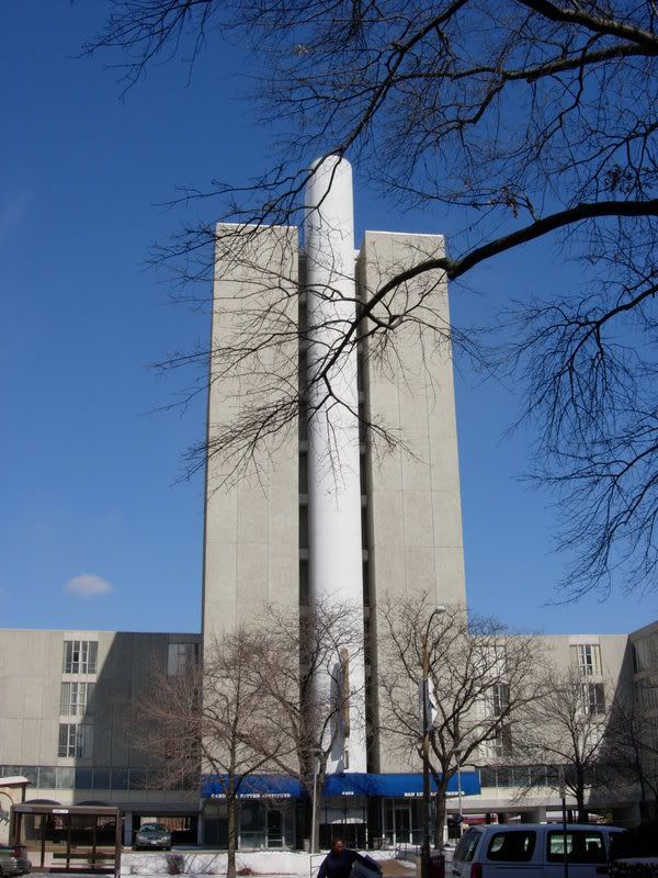
As demolition of the Doctor's Building is complete, and the threat of the San Luis Apartments demolition grows more tangible, I just have to ask one question regarding the targeting of mid-century architecture and what ultimately replaces it: why?


In the case of the Doctor's Building, the new denizen of the site will at least be urban in form and keep a mixed-use presence on the site, even filling in the land on which the parking lot that the Doctor's Building originally claimed for its own construction rests. But concerns over why the building had to be demolished at all remain, as well as doubts about the quality of the design of the new project. Michael Allen wrote a beautiful essay on the Doctor's Building and another on his qualms about the proposed development over at Ecology of Absence.


In the case of the San Luis Apartments, (or crazy, funky mod building with three compound fractures, if you will) the St. Louis Archdiocese intends to turn the site into a surface parking lot. Vanishing STL has more on their plans to establish a "campus" where now only a "hodgepodge that happened over time" exists with regards to buildings. Those are the words of our spiritual leaders, folks. Check the full story out here.


I might add, on a bit of a tangent, that this "campus" mentality is what fuels St. Louis University to rid of its own troublesome "hodgepodge" and seek a unified, faux-Gothic appearance punctuated by green space. It's as if the city and its neighborhoods are once again canvasses from a time of urban renewal, where blocks can be closed, buildings torn down, people uprooted, churches and institutions drained of their members, and once active urban spaces with the potential to be such again reduced to parking lots and garages--all in the name of creating a logical "campus". It's a mortifying confirmation of SLU's and the Archdiocese's view of the city and their respective roles within it--that the city's complexities, those that render it interesting and unpredictable and urban, can be done away with in order to produce a sterilized, definable, controllable, and marketable "place."


Any Mid-Century Modern proponent should look further back to what is St. Louis's perhaps most egregious abuse of land in a direct violation of what neighborhood residents originally demanded. Look no further than the northeast corner of the intersection of Chippewa and Kingshighway, where four neighborhoods and a whole lot of pedestrian and automobile traffic converge.


This was what the corner used to convey when the old Famous-Barr Southtown store was constructed in 1951. Though its massive scale and caustic materials may have hurt its chances at recognition as "historic" in the 21st century, there is a lot to commend about this structure, demolished in 1995. In typical streamlined modern fashion, the building adhered to a classical form while showing it up on the massing and using bolder materials. That is, this building has great respect for this large and heavily trafficked corner with its dramatic curvaceousness. It commandeered this intersection with its very presence, so much so that one barely notices the gas station in the foreground. Combined with the northwestern block of buildings of this intersection, this is unmistakably an urban neighborhood.


Fast forward to 2005, and construction has been completed on a new commercial strip center over the site of the old Famous. The result is a dreary and awkward design that can't even compete with the suburban counterparts it has attempted to emulate. One of the outbuildings abuts Chippewa, albeit about eight feet above it, and shows its backside, literally and figuratively, to the passers-by below. A Walgreens store occupies the parcel closest to the corner, but with a spacious row of parking and a non-sensical triumphal arch/bus shelter(?) that urges the otherwise overlooked pedestrian to jog across a parking lot to purchase wares that can be found in an identical store in Des Peres or dozens of other St. Louis suburbs.


The neighborhood fought a K-Mart store that was interested in the 11 acre lot in the late 1990s and early 2000s. The "Southside Coalition" headed by John Klevorn pressed for an urban, mixed-use replacement to the felled Famous. Per an April 5, 2000 Riverfront Times article:


[14th Ward Alderman Stephen] Gregali, Klevorn and the Southside Coalition have a different plan for the long-empty corner, and Kmart is not a part of it. Instead of one "big-box" development, they envision two or three smaller stores, something along the lines of an Old Navy, Circuit City or T.J. Maxx, connected by smaller storefronts featuring the likes of a St. Louis Bread Co. or other small stores and restaurants. In their plan, the stores would be close to the street and the parking would be behind the stores -- still free, just not as visible from the street. The bricks and architecture would be more suited to the surrounding apartments and businesses, similar to the strip on South Grand Boulevard at Arsenal Street.


The coalition produced a rendering depicting what they would like on the site. Contrast it to the photos above.
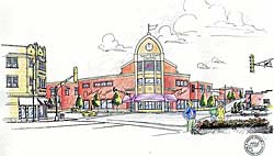


Interestingly, this drama unfolded the year that Mayor Francis Slay, then President of the Board of Aldermen, began his first campaign against incumbent Clarence Harmon. Slay said of the Southtown site, "This issue is too important to sit idly by and watch from the sidelines."


This quote makes the result of the K-Mart protest all the more surprising. The announcement of a first ever urban PetSmart drew excitement, and the redundancy of an Office Max addition to the neighborhood (with the Office Depot store in the old Venture strip center further south on Kingshighway) was forgiven. And Walgreens did in fact move from a declining strip center across Chippewa to a new building on the site, as rumored. Failing to see the follies of shifting commercial boxes around doomed strip centers, the leadership suddenly dropped the activist role and began to back the development on the site as we now know it.


The recent exchange between Steve Patterson and still-Alderman Stephen Gregali is classic and must be read to be believed. The Southtown reference is toward the end. At least Gregali spoke on the issue when prodded; in great irony, Mayor Slay has "sat idly by" and has remained mum.


Despite a new tenant (the Army Corps of Engineers) and a proposed pizza joint, the center has been a remarkable failure, with most of the storefronts on the northern building never even leased. An urban clothing store and a Verizon Wireless store have already faltered, and the Cold Stone Creamery had, at least at one point, switched to "seasonal" hours.


Okay. So what is my point? Go back to the beginning of this post and look at the old Famous building. Look at what replaced it. Do St. Louis and its leaders and residents not have the power or the will to demand better? In Southtown's case, all seemed aligned to ensure that the loss of this urban building would not be for naught; that the vacant lot would be filled with a worthy successor that would live to see not just its 50th, but perhaps its 100th anniversary. What happened? This case shows the vigilance and dedication it takes to be a proper steward to St. Louis's built environment. Vocal protest of a big box may not be enough; it may require vocal advocacy for what would be better than the box.


In retrospect, or at least in comparison to what's there today, the mid-century Southtown Famous Barr should have remained; its presence was stunning and bold and, yes, even urban. Mixed-use redevelopment of the building seemed entirely possible with a creative mind and equally creating financing. Instead we have lost not just a magnificent urban department store, we have lost that very corner itself.


Who knows how long it will be until this site is rebuilt again. Will we, at that point, demand something lasting, something beautiful, something truly fitting for St. Louis? Or will we play strip center shuffle yet again?


Let this stand as a warning for West Pine and Euclid, and for Taylor and Lindell. That mid-century building you think is ugly and outmoded--wait until you see what this century produces.


[Photographs of Southtown Centre courtesy of Urban Review St. Louis.]

Saturday, March 29, 2008

Unique St. Louis architectural style: the free-standing Flounder


Reviewing the St. Louis Cultural Resources Office's reports, demolition reviews, etc. might not sound like an exciting way to spend a Saturday (or any day, for that matter), but preservationists and architectural enthusiasts will understand. I like to see what owners feel can't--or shouldn't--be rehabilitated. I like to read the testimony of impassioned neighborhood activists who believe that simply erasing their significantly vacant built environments eradicates the problems of the neighborhood all at once. I like to read the counter-stories to these testimonies; the ardent preservation advocates who call for patience and, with it, a sensitivity to the built environment, a recognition of its potential benefits for the community in the long run. These may sound like mundane arguments taking place in stuffy government buildings away from sight for most of us, but, to preservationists, these are the soap operas that define our profession, or hobby, or side-job, or all of the above.

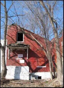
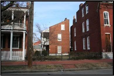
Every once in a while, though, you learn something from giving the neighborhoods around you a closer look. I had never noticed that the building pictured in this post is in fact a style only found in St. Louis: the free-standing flounder building. You may have seen these as back or side units attached to 19th century rowhouses and such (usually with a more steeply pitched half-roof than this one has), but have you ever seen one with street frontage and its own spotlight?
According to the report, the flounder house is threatened with demolition. Located in the eastern portion of the Tower Grove East neighborhood (nearer to Gravois), this house at 2915 Minnesota is said to be one of the only remaining homes of its type in the city. Due to its condition and neighbors' complaints, however, 6th Ward Alderperson Kacie Starr Triplett has requested that it be torn down.
On a side note, who that doesn't live in the ward realized that this was the 6th Ward? I thought that that ward was more Lafayette Square/Gate District/Downtown West-centric, but apparently there's some gerrymandering of some sorts going on.
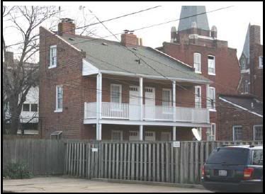
Anyhow, to shorten the story, Kate Shea of Cultural Resources recommended the building be saved, citing examples of similarly shaped and sized (at a decidedly tiny square footage of 527) that were spared the wrecking ball treatment. Those pictured below are in Soulard and Benton Park (not sure which, to be honest).


I found this report interesting for two reasons. I loved that this is a unique St. Louis style (who that is not claustrophobic can resist the unbearable cuteness of the rehabbed Soulardian/Bentonian flounders?). And I was also amazed that, as a city, despite our preservation-by-neglect (translation: couldn't afford demolition) approach to the field, people are still, in 2008, willing to see buildings simply removed from the landscape. They would rather have a vacant lot than a potentially tax-paying, living, breathing fellow citizen as a neighbor--architectural admiration issues notwithstanding.

That's the wrong direction for St. Louis. I hope to do an extensive post on the Ville Neighborhood in the future. That neighborhood, the cradle of St. Louis's black culture and our own little "Harlem" of the Midwest, has seen rampant decay and subsequent demolitions. The Aldermen have come and gone, and the buildings have done so more quickly. Horrific, anti-urban infill has popped up and has compromised the context of this all-too-important and historic neighborhood. Enough remains to rebuild the Ville and restore it to its proper prominence, but that is quickly changing at the insistence of its own leadership (as well as the complicity of the other aldermen and the mayor).

Destroying an empty building does not solve the problems of urban neighborhoods; it merely further empties the neighborhood and chips away at extant investment opportunities. This makes little long-term economic, ecological, civic, or cultural sense. So why do we do it?

It is more likely that the Tower Grove East flounder house will be saved. It is located in a "viable" neighborhood. But if even it is threatened, this rare and unique style of building, it does not bode well for our more isolated and "written-off" areas such as the Ville, where poor residents who have stuck with the neighborhood are fed the message that if only they can quash these problem properties and see them reduced to rubble, somehow peace will return to their own plots of land.

It's disingenuous, short-sighted, and wrong. St. Louis, to be cliche, deserves better. As do Tower Grove East on the South Side and the Ville on the North.

Friday, March 28, 2008

St. Louis needs more neutral grounds, err...medians

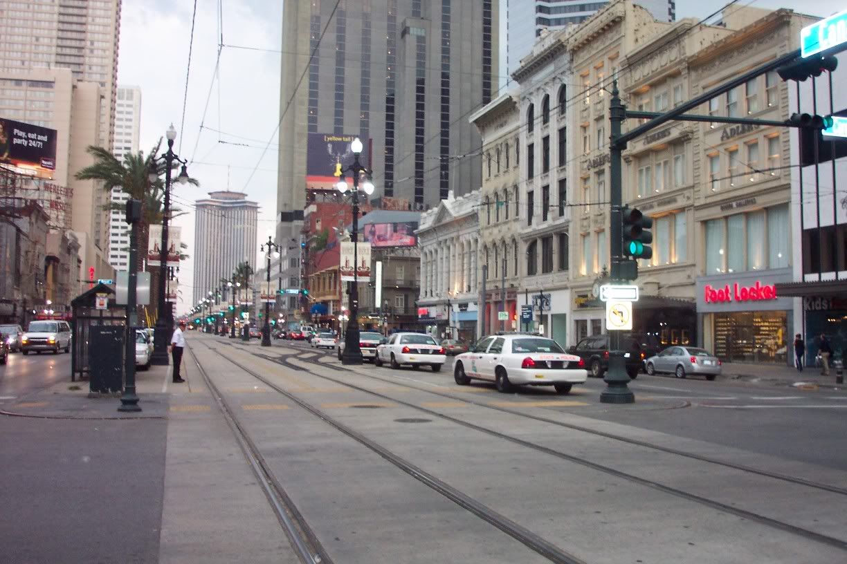
The story goes that, in the early 1800s, Creoles in New Orleans' French Quarter and Americans in what is now the Central Business District (then Faubourg St. Mary) had established separate cities with separate governments and separate cultures. Where the two collided, along Canal Street, the central portion of the street was the only permissible point of diffusion between the two starkly different and antagonistic cultures. The Canal Street median, as St. Louisans might call it, became known as the "neutral ground"--a designation which now applies to all medians in New Orleans.

It should also be noted that New Orleans is simply crazy about the neutral ground. Some are incredibly wide and feature walking paths. Others, even post-storm when New Orleans' Magnolia Trees were largely lost, are lushly planted and beautiful year-round thanks to the city's subtropical climate. St. Charles Avenue and yes, Canal, feature streetcar tracks in their neutral grounds. In almost all of them, spectacular Live Oaks contort above the streetscape as if inverted, their twisted roots on display instead of more orderly branches.


This is the St. Charles streetcar running through Uptown New Orleans. On days with good weather (defined as 68 degrees and up, light rain or less by native New Orleanians), you will see joggers and sightseers sharing right-of-way with the clanging streetcars.


Historic photograph of the Canal Street neutral ground, circa 1850s.


And a more current photo of Canal Street, now with streetcar tracks.


But, I digress. The point I'm trying to make is better demonstrated above (streetcars are a ways off for St. Louis). Here is an entirely doable project to improve pedestrian friendliness of St. Louis streets. Above is Jefferson Davis Parkway in New Orleans. It may look like a full blown park, but this in fact is a center median. It's huge--and it has the effect of slowing down traffic and providing a comfortable cushion for the pedestrian from the traffic that does exist. It's also very aesthetically pleasing.


Oh, and these are Live Oaks, by the way. These have Spanish Moss growing on their branches.

St. Louis has some notable wide median streets. Private streets such as Portland and Westmoreland have them, as do public streets Bellerive, Reber Place, and Holly Hills on the South Side. Russell has a mini-median. Lewis Place, pictured below, is a prominent "medianed" street on the North Side.


If there is a lesson from New Orleans, it's that these medians, or neutral grounds, should be accessible, active public spaces, much like linear parks, rather than private gardens or mere decoration. Imagine South Kingshighway with a large, somewhat flat median (unlike the rather new medians placed on South Grand and Tucker Boulevard, which seem too tall and do not invite active use) in the center, attractively planted with greenery and walking paths. Traffic would be slowed and--gasp--pedestrians might feel safe crossing over to Tower Grove Park to the east. Instead of the street being treated as a literal highway, it might instead be a grandiose urban boulevard that both efficiently carries traffic and accommodates pedestrians. Plus, as New Orleans has also shown, these designs provide built-in opportunities for in-street light rail/streetcar transportation.

I say that St. Louis should shuck its neutrality and fully embrace the New Orleans-style neutral ground.

[Edit: (3/29/08) A New Orleanian kindly informed me that 60 degrees is, I quote, "cold."]

Thursday, March 27, 2008

I want to lease a space in Slay's "world-class" office park, a.k.a. Ballpark Village

By now, all St. Louisans are aware that, if Ballpark Village even gets off the ground, Centene Corp. won't be moving from its Clayton abode to a front row seat to Cardinals' games.

That's okay, though, because Mayor Slay doesn't mind a bit of a change of plans, per today's mayorslay.com blog post:

First, I want a world-class development built. What will it be? The Cardinals want to shift from condos to office space. I am fine with that. Downtown needs more office space and more jobs.


All right. So those seeking a mixed use "neighborhood" to fill the current crater (some jokester has changed the name of the Village on its wikipedia page to "Crater Village") should be resigned to "Officepark Village"? I guess City Hall thinks so.


Wait--village? Doesn't that suggest a residential community? Ballpark Business District sound more fitting, Mayor Slay? That better include some world-class Class A office space!


It's probably for the better. Ambitious redevelopments backed by Slay tend to have some nasty strings attached:


Century Building demolition photo courtesy of Built St. Louis

Wednesday, March 26, 2008

This is a sick city; I need say little more


September 2006, pre-Blairmont


February 2008, post-Blairmont

The photos are from Built St. Louis's blog, and specifically the devastating, heartbreaking, galvanizing "Daily Dose of Blairmont" series, in which 23 and counting daily posts of photos and text tell the story plainly and bluntly in the absence of the most minimal iota of civic leadership that would have already addressed the historic preservation, poverty, forced gentrification, top-down and secretive planning issues involved with Blairmont's urban "slash and burn" on St. Louis's Near North Side.

After August 29, 2005, nearly all topics in New Orleans are divided into the two categories of "Pre-Katrina" or "Post-Katrina," "pre-storm" or "post-storm". Katrina was a natural disaster, an "act of God" as it is often termed. Blairmont is an act of failed leadership, of reprehensible disrespect to an irreplaceable urban neighborhood, to its already destitute denizens, to its already rapidly fizzling history and heritage. Blairmont is a disaster not simply "avoidable"--it is a crime (nuisance laws, property code) and its insidiousness and malevolence is perhaps unprecedented in all the history of misguided or absent planning to which St. Louis claims an all too clearcut association. In short, it should have never been allowed. The first inklings of the scheme should have attracted City Hall's scrutiny; so far, all the Mayor's Office has done is encourage McKee's quite literal blockbusting.

I fear for the post-Blairmont city, a disaster in slow motion, but, sadly, one as monstrously inexorable. As we observe the landscape in the wake of its devastation, how sorely will we regret it?

Tuesday, March 25, 2008

My review of St. Louis, three months removed

Today would have been three months since I had seen St. Louis in person, since I left the city on Christmas day of last year. And while I'm back in New Orleans on that anniversary, we will go ahead and call it a true three month hiatus from visiting the city that smites me so.

Most of my time was spent with family, on whom I was reliant for transportation (Metro doesn't exactly have a makeshift St. Louis architectural tour route, so I needed the family car for my exploration!).

But I did get around in my brief stay, and, as usual, did fall in love with the city even more in my absence from it, where its deep, even solemn red bricks seem to contrast ever more starkly upon each successive visit with the playfulness of the painter's palette of Creole cottages here in the Crescent City.

I made it to a couple spots I've been wanting to try out:

I had been to Everest Cafe before (at its Washington Avenue iteration in a long forlorn section of Downtown West just across from the under-renovation "Tudor Building"), but its move to a smaller, sleeker storefront in the Grove (Forest Park Southeast for the change-resistant among us) along Manchester made Everest seem like an altogether new and exciting place for me. I finally made my way to their 4145 Manchester location. I was blown away by the crowds on both days I visited (yes--I went twice--it's that good!). At the previous location, one could hear the soothing sounds of Nepal, which sound to me like the low humming of Tibetan monks, over the din of the always less-than-half-full restaurant. Not so anymore. The slightly smaller space and different acoustics make the Grove location appear hopping. The food, of course, is amazing. While known as Everest Cafe, the husband and wife duo that run the restaurant are actually Nepalese and Korean, respectively, and so, owners Devi and Connie States market their offerings as follows:

Welcome to Everest Café
“The Only Restaurant Serving Nepalese & Korean Cuisine in St. Louis”

Nepalese food is known as cuisine of the Himalayas. It has its own identity with influence from Indian spicy curries to momo (dumplings) from Tibet. Nepalese food is famous for its nutrition level and tempting taste, with the use of spices and flavorings such as ginger, garlic, coriander, pepper, cumin, cardamom, bay leaf, cinnamon, clove, chilies, cilantro, turmeric, and Himalayan herbs.

Korean food is a wonderful combination of Chinese and Japanese mixed with its own distinctive elements. The food has a full-flavored taste that defies the winter ice and snow, most notably in the national dish, kim chi, a spicy pickle served at every meal. Korean meals are made up of many small, tempting dishes, flavored with soy sauce, garlic, ginger, bean paste, and toasted sesame seeds.


The decor has remained mostly the same, but the lighter, airier, and more open plan of Washington Avenue has given way to Manchester's darker colors and multitude of "rooms". The result is an excellent addition to the continually improving Grove commercial strip (while After Diner across the street from Everest has closed, the Gramophone music venue has opened up in the 4200 block), with a healthy alternative to the offerings of Agave and Atomic Cowboy.


I also went to Buffalo Brew House, one of the Locust Business District's latest offerings in a stretch of St. Louis that I never really expected to see a boom take place. Olive Street east of Compton has been attacked by demolitions, recladdings, crime, but most importantly, emptiness for a long time. Once a major east-west thoroughfare through the city, lately it has served as an abandoned (and overly wide and pedestrian unfriendly) highway from the environs of St. Louis University to downtown. So to see nightclub Lush and now Buffalo Brew House call Olive Street home (along with a spate of other announced tenants) was quite the surprise.


(By the way, the Locust Business District has really shown up the Grove in the e-arena. The LBD's website is revamped, attractive, and user-friendly. Where is the Grove's?)


My experience was mostly pleasant. I opted to try to burger (yeah, I know, exciting choice--get over it), which was as good as any I've had in St. Louis. There was live music. The size of the space and its acoustics seemed a bit prohibitive of loud music, but nevertheless, the band played on--and played loudly. I found it extremely difficult to talk to someone from across the table, but, in all fairness, I was there for a fairly late dinner. I'm just happy that SLU students have an off-campus choice for dining given the dismal state of on-campus offerings (unless something's radically changed since my graduation from SLU in May 2007).


The Fountain on Locust was particularly surprising. The Art Deco motif is entirely successful, and the place is a delightful addition to St. Louis's already superb ice cream "scene" (Crown Candy and Ted Drewes, of course).


I had two scoops of Coconut Almond the first visit, and a Coke float the second--both amazing (I know, another double visit--I'm obsessed).


The Fountain was a much needed addition to St. Louis. It will most likely jumpstart the movement to revive St. Louis's historic "Automotive Row" on Locust Street (that is, if SLU doesn't get in the way...). Further, it ups the ante for local businesses for creativity, as the Fountain simply went above and beyond in the design department. New Orleans coffeeshops, for example, seem in competition to distinguish themselves as more than a room with baristas and for-sale paintings on the wall. One features a British telephone booth circa 1950s for cell phone users, while the next features outlandish paintings that line every square inch of walls that connect to a 15-foot ceiling. St. Louis needs this creative entrepreneurship as well, the kind that truly differentiates the local business from the corporate chain and therefore more likely returns dollars to the local economy and offers up unique, local flair to boot.


I will probably do another post on my short stay in St. Louis. I didn't actually get up to Baden's business district to take some photos, but I may send a captive photographer up to get some shots on my behalf. We shall see.

Thursday, March 20, 2008

Greetings from the Gateway!

Ah, my first post from the soil of St. Louis. After arriving in Carbondale, Illinois on a late Amtrak train, I took a small shuttle to St. Louis and I'll be damned if I did not wake up just in time to see the skyline impose itself upon the still decidedly sullen and wintry Southern Illinois industrial landscape.

Since my stay is rather short (until Monday), I cannot promise a lot, but I do hope to take my own pictures of the next St. Louis Main Street. Of course, I cannot tell you which, but I can give you just one small clue:

Willkommen!

'Til then.

Tuesday, March 18, 2008

Ambivalence


Another photo from the Mercantile Library's Globe Democrat collection. Looking east on Chestnut Street from 17th.

This neighborhood was once called Lucas Place (or, at least, was one street over from said neighborhood).

To see the demolitions of these rowhouses in downtown is painful, but I am convinced that the resulting Plaza Square Apartments (for which this site is being prepped--circa late 1950s) constitute a sound replacement. Built in 1961, Plaza Square is the first site in St. Louis (to my knowledge) to be listed on the National Register of Historic Places prior to its 50th birthday (it was placed on the list summer of last year).

This is a meandering post, reflecting my ambivalence about what I see--the potential of those buildings that was lost on those that financed this project and yet my affinity for Plaza Square.

I suppose I'm happy we have something to remind us of the good old days of Lucas Place, one of the first "suburbs" of St. Louis and truly the first leg of the westward march of the middle and upper class of our city.


The Campbell House (c. 1851) at 1508 Locust is now a museum, some of which is dedicated to Lucas Place itself.


Sometimes diminishing contexts give way to a new and equally good context. Unfortunately, as of late, this is becoming ever so rare in our fine city.

Ahem...

Monday, March 17, 2008

Demolition Alert [St. Louis University edition]: the Wagner House

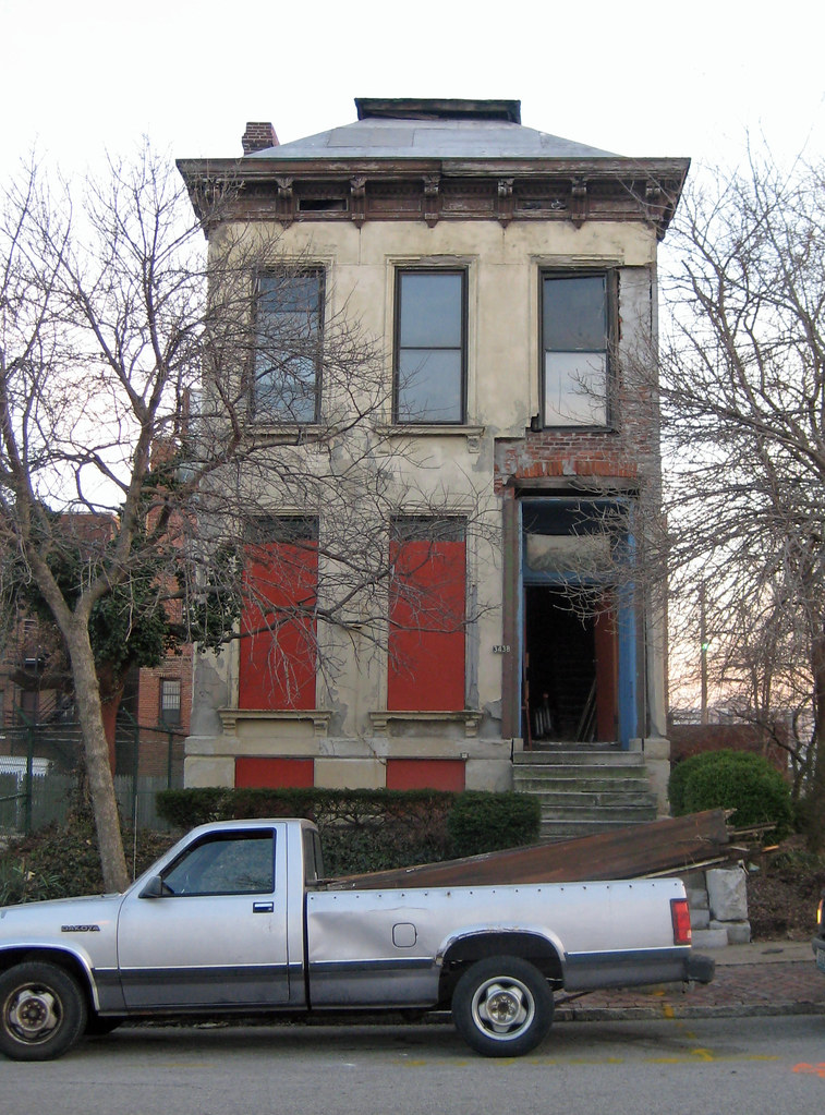
Unconscionable. St. Louis University continues to deface the built environment and derail the very stability they’re typically credited with bestowing upon the Midtown and Grand Center neighborhoods. The latest victim of SLU’s parking preference is the demolition of the Wagner House at 3438 Samuel Shepard, as reported first by Vanishing STL. (The photographs below are all property of Vanishing STL.)


I call it the “parking preference” because parking lots, chiefly, and garages, secondarily, receive preferential treatment among land uses by officials at St. Louis University.


The Wagner House is one of the few remaining row houses in St. Louis’s central corridor. If within a series of intact rows, this structure on Samuel Shepard would have appeared a member of a stately block more typical of urban Brooklyn than somewhat spread-out St. Louis.


But SLU has been given a pass by an unwitting or indifferent public. Typically, you will hear the remark that the university "saved" Midtown and that there's simply no saying what the neighborhood would be like without the strong institutional anchor that is SLU. Father Lawrence Biondi, S.J. (President of SLU) was even named "Citizen of the Year" in 2005 by a group of former recipients who had received the award themselves for demonstrating "concern for St. Louis' growth and vitality," presumably for redevelopment efforts and those same attributions of SLU to the health of Midtown.


Yes, there's the Moolah, the Continental Life Building, the Coronado, and the Warehouse of Fixtures that all saw rebirth either on direct or indirect account of SLU's presence. The importance of each one of these buildings cannot be overstated.


And yet, as always, it's the architectural "little guy" that's allowed to atrophy: the one that's off the beaten path; the one that's been vacant for years; the one that's stately but not imposing; the one that it takes just an ounce of vision to respect and recognize that it is vital to the future of its home block. Perhaps, more simply, the one that's on a small enough scale to easily demolish.


While I would argue the Wagner House is a profound, elegant example of a limestone faced Italianate Row House, it still appears quite forlorn as a vacant building on a street now sadly devoid of almost any residential use (one of the many of that type found in St. Louis's illustrious and almost single-use arts district, Grand Center).


The cycle takes one step further here. With each footing of urbanity lost, another demolition is justified. The loss of the Livery Stable just to the east in the burgeoning Locust Business District quite likely represented a vindictive land grab by a powerful institution with a pretty public face. The turn of the century historic building was felled for a surface parking lot--in 2007 (this century)--all to serve the rather distant new SLU sports arena on Compton. The June 20, 2007 Riverfront Times Article "Rebuilt to Suit" is an illuminating investigative piece on SLU's bullying of business district entrepreneurs in order that they might demolish the very stock of buildings that makes the district a prime candidate for reinvigoration and is the only hope of an adjacent, pedestrian-friendly retail area to serve the university.


The salt in the wound is that SLU represents a top-down planning approach inspired by the Urban Renewal mentality that awarded them half of their campus's land--an approach diametrically opposed to the smaller scale, more organic approach of the Locust Business District and its associated partners.


Thirty-seven forty Lindell, right on SLU's campus, was also lost, this time to plans for a new law school:


[Edit (3/20/08): Just drove by the site today. Woops! Didn't realize this building was still up. I'm pretty sure that SLU's plans are still to tear it down for the new law school.]


Without going into SLU's more distant past of demolitions, the case can be made that SLU is a detriment to the neighborhood in which it is situated for no greater reason than that it has effectively dismantled whatever neighborhood existed.


If the argument is whether SLU has presented an economic boon to the city, then I would argue on the side that it is very beneficial for the city. Does that mean it's been kind to its neighbors? Not at all. In fact, if SLU were in a preservation-friendly neighborhood that would have reigned in its quest to acquire land for new construction at any cost, we might have seen a mutual benefit, a kind interplay between institution and neighborhood that can prove a best case scenario. Tulane and Loyola Universities in New Orleans, while not perfect, are good examples of universities that remained sensitive and complementary to historic neighborhoods and their unrivaled amenities: historic buildings and lively public spaces.


A friend of mine here in New Orleans comes to mind. She was speaking on her neighborhood association--located in a very stable, middle class Uptown enclave--and its responsibilities. I inquired as to what major concerns the neighborhood, called Touro after its institutional anchor (a healthcare facility), has.

Bluntly, she responded, "Well, sometimes the hospital's an asshole."


As a struggling city, St. Louis must not fear to oppose its institutions, which should be lifebloods rather than bloodletters, when they are, in fact, being assholes.


And, of course, please contact 19th Ward Alderperson Marlene Davis and let her know your concerns over this demolition.

Saturday, March 15, 2008

St. Louis Main Streets: Cherokee

In the previous post, I noted that St. Louis had no National Trust "Main Streets". Cherokee should be its first.


The nearly one and a half mile stretch of Cherokee Street in St. Louis is definitely one of St. Louis's most notable drags. On the eastern end, the magnificent Lemp Brewery complex awaits redevelopment.


Heading west, the "Antique Row" stretches until just about Jefferson Street. With its namesake's stores scattered about, one will also find an unexpected rare treasure for St. Louis--the magnificent vegan and vegetarian diner, Shangri-La as well as one of the city's most comfy coffeehouses, the Mississippi Mud House.

Moving on to South Jefferson, kitsch gets its proper dues with a rather stereotypical depiction of a Native American (presumably a Cherokee) at the gateway to the "Cherokee Station" shopping district, once a verifiable "downtown" for South St. Louis--an unabashed Main Street. In the middle of the district, a small but growing Latino/a population has injected much-needed life into a series of blocks. Formerly moribund blocks now pop with color, sidewalks once again are graced with sauntering pedestrians, and parking meters once starved for change now have their fill. Taquerias, grocers, and discount retail occupies these couple blocks. Look for one of St. Louis's best street festivals at Cinco de Mayo time.


After passing new record store Apop, you'll be out of the burgeoning ethnic enclave and you'll be on your way to an as-we-speak incubating indie arts district pioneered by Fort Gondo's Galen Gondolfi. Bookending the western portion will very soon be the Royale's Steve Smith's new alcoholic establishment, so look for that.

The photographs are courtesy of the Urban St. Louis forum member Jax.

While the pictures above do not display many pedestrians, Cherokee Street is nevertheless an active business district at peak hours. It features several shops and restaurants, but many storefronts are empty. It has many potential anchors (the Lemp Brewery being the big one) that could serve as a catalyst to neighborhood improvement, but are currently underutilized. It is already a pedestrian friendly street, especially by St. Louis standards. The street width and traffic speed are acceptable, stop signs (sometimes obeyed!) adorn each block for the most part, and Bike St. Louis now runs down the length of Cherokee. In short, with investment and careful assemblage of business owners toward the common goal of improving Cherokee, we might see a major difference on the street. The Main Streets program would, with any luck and determination, do just that.

And I am not speaking of any insidious gentrification; rather, new businesses should receive assistance in their move to Cherokee; the streetscape should be updated and made even more attractive; and tourists (as well as visitors from farflung parts of the region) should wander their way down to St. Louis's funkiest commercial street via better promotion and signage.

Cherokee should be St. Louis's first Main Street.

Friday, March 14, 2008

Why no St. Louis "Main Streets"?

Chicago has two. New Orleans has four. Detroit has eight. But St. Louis has none.

What is a "Main Street" and why do I have it entrapped by quotation marks? The Main Street Program is...well, let's let the Trust explain:

In the 1970s, the National Trust developed its pioneering Main Street approach to commercial district revitalization, an innovative methodology that combines historic preservation with economic development to restore prosperity and vitality to downtowns and neighborhood business districts. Today, the message has spread, as the Center advocates a comprehensive approach that rural and urban communities alike can use to revitalize their traditional commercial areas through historic preservation and grassroots-based economic development. It has created a network of more than 40 statewide, citywide, and countywide Main Street programs with more than 1,200 active Main Street programs nationally.

The Main Street "Four Point Approach" is a strategy to redevelop ailing "main streets", both urban and rural, or bolster those that already have significant assets. The four points are Design, Organization, Promotion, and Economic Restructuring--affectionately abbreviated D.O.P.E. by those witty enough to notice. A "Main Street" gets a manager (much like a mall) to whom all emerging concerns filter, while an organized collection of business owners work together to make the Main Street attractive, lively, and, most important, financially viable. It has been called the Trust's greatest program and studies have shown for every one Main Street dollar invested, 38 return.

The project started off as a pilot project in the Midwest and only applied to cities with fewer than 100,000 people, as rural decline at the time was perhaps at an even greater crisis than its better publicized urban counterpart. Urban Main Streets are now fairly common, with Boston having led the way with its remarkable pouring of support into the program.

In future updates, I will argue my choices for the St. Louis Main Street Program. This program boasts of several features that make it a clear choice for St. Louis: it is in effect a "subsidy" for local businesses (rather than the TIFs and other incentives handed out to large developers who bring national chains to the table and nothing else); it encourages rehabilitations of long suffering commercial corridors that are seen as outmoded today; and it has worked in so many places. In short, it quietly kills that destructive adage that historic preservation and economic development are diametric opposites.

Stay posted.

Bohemian Hill, Part II

As promised earlier, here is the second part of my October 2007 post on the demise of Bohemian Hill (sans preachy intro--thank God!). If you'd like to view part one, click here.

There seems to be a bit of confusion as to the ultimate fate of the buildings along Tucker Boulevard–some of Bohemian Hill’s last remaining housing. After a battle with Jim Roos (who had the building facing the I-44/I-55 interchange painted with the words “stop eminent domain abuse” inexplicably crossed out) and concerned residents, the city has apparently, for now, given up on its quest to seize these houses.

Bohemian Hill, what’s left of it, that is, is far from safe though. With the departure of the Century Building and its onetime ground floor tenant Walgreens, the city of St. Louis has not one Walgreens that has “hermit crabbed” into an older structure. All are new construction, and all new Walgreens have the same basic architectural elements, if ascribing the word “architecture” to such formulaic construction is even accurate in the first place. Perhaps more importantly, not one has a truly urban format.

I suppose the most walkable Walgreens is Grand and Gravois, which has an entrance that abuts the sidewalk along Gravois. It pains me to give that Walgreens site any sort of distinction though in light of its builders bullheaded, shortsighted, and downright asinine insistence upon pressing for demolition of the now-rehabbed art-deco beauty once known as the Southside National Bank building, a.k.a. the South Side Tower. Luckily the effort failed and they were relegated to the side of a major street just steps away from the corner of Grand and Gravois. Of course, as you know, Walgreens stores can’t succeed without a high profile, visible corner. Let the eye-rolling begin: the “Grand and Gravois” Walgreens is doing just fine.

But I digress. Needless to say, when Walgreens sets a footprint on Bohemian Hill, even if it is as currently planned (to build around the existing structures), that shrivel of a context of a neighborhood will be lost. We cannot have a generic Walgreens as a neighbor to these buildings. Simply put, what is right now difficult to recognize as a part of greater Frenchtown will appear even more out of place next to a suburban Walgreens store.

Plus, there is the thought that Gilded Age/Koman will design the shopping complex (known as Georgian Square) with loading docks facing 13th Street, thus visually polluting the properties along that street, including the year 2000-constructed infill housing, with the hope of convincing owners to sell for future shopping center expansion opportunities. I would list these properties as endangered.

The current site plan, however, makes it difficult to determine what the intent of the developers is. Since the city’s announcement that it will not seek to buy out the Bohemian Hill homes, Gilded Age/Koman has not released renderings that reflect the preservation of these homes.

From Koman’s website:


Buildings “H” through “M” would clear everything on the site. By the renderings, 13th street looks to be street level retail, even mixed use with residential atop. Who knows what to trust? Renderings are so temporary.

The point of these posts is not to chase away investment from St. Louis, as some of my detractors have said. Sure, I do think that these large developments that invite all the typical chains into the urban landscape (Starbucks, Panera, Walgreens, Qdoba) without the urban form are misguided and not necessarily good at all for our city. Still, I’m sure residents of the surrounding neighborhoods will be pleased to have a grocery store in the immediate neighborhood. When I lived in the 1000 block of Dolman in Lafayette Square, I used to either walk to the Salama Market (a small and to my knowledge local chain serving mostly Clinton Peabody residents, located on Chouteau at the end of the new Truman Parkway), drive to City Grocers if it was just an item or two, or I would drive to the Schnucks at Grand and Potomac. Blech, by the way on that last one.

Shooing away development dollars and needed services is not the message from atop my soapbox. What I hope to bring to your attention is the opportunity (the need?) for the city to work with the developer to provide a different site–or to integrate their retail with the reestablishment of Bohemian Hill as a residential neighborhood.

After all, South African architect Jo Noero developed a site plan for Bohemian Hill that envisioned a neighborhood punctuated with infill housing not unlike what sits today on S. 13th Street just south of Lafayette. Of course, in 2001, when the Missouri Alliance for Historic Preservation recognized the site plan as a recipient of the McReynold’s award for architectural preservation, much more of Bohemian Hill’s older housing stock was present.

Read the story here and see the site plan below.


Unfortunately, this small, blurry photo is all I can offer. Still, imagine the possibilities of creating a new mixed use neighborhood, having preserved all of the old in the process. In my opinion, Noero’s models are splendid urban homes that evoke elements of the old while retaining a distinct post-post-modern look. Imagine a neighborhood that included these houses and incorporated the larger retail proposed by Koman/Gilded Age on the larger corner lots at Lafayette and Tucker and Lafayette and 13th?


Courtesy of Rob Powers’ Built St. Louis

Isn’t it sad that in St. Louis today, that kind of development is expressly unthinkable–even forbidden by outmoded zoning?

This retail could have gone into a reformatted I-44/55 interchange (which needs to happen anyway–what a waste of land!). It could have even gone into the wedge along the western side of Truman Parkway with some skilled planning. Or hey–how about building onto the massive parking lot behind the Georgian (former City Hospital) and replacing it with retail buildings and structured parking?

Oh…I forgot for a second. Visibility and extra parking is more important than the legacy of one of St. Louis’s fine and nearly forgotten neighborhoods.

Tuesday, March 11, 2008

Mill Creek Valley - Urban Renewal circa 1972


© 2005 St. Louis Mercantile Library at the University of Missouri St. Louis

Here is the description, courtesy of the St. Louis Mercantile Library at UMSL:

St. Louis - Seventy-five new apartments have been erected just west of LaClede Town, foreground. The apartments are part of Operation Breakthrough and the LaClede Town Corporation is to be the rental agent. Compton Avenue is in the foreground and Laclede Avenue is at the left in this aerial view. 14 February 1972 by Paul Ockrassa.


Note that Laclede Town itself was torn down in the 1990s. The beneficiary? Greenspace for SLU, a SLU parking garage, an expansion of Harris Stowe, and a stadium for SLU--but no residential (not counting a nearby student dorm for Harris Stowe students). Further note that Mill Creek once had 20,000 residents and all types of land uses, like most urban neighborhoods originating from the late 19th century.

Mid-Century Modernism: Demolition Alert!

San Luis Apartments
4483 Lindell Blvd. (at Taylor)
St. Louis, Missouri - Central West End
Built: 1962
Demolisher: St. Louis Archdiocese
Date: Permit not received yet; demolition date to be decided
Future use: surface parking lot

Thanks to JivecitySTL of the Urban St. Louis forums for the pictures below!


If you'd like to contact the Archdiocese of St. Louis, you may do so here.

If you'd like to contact 28th Ward Alderman Lyda Krewson to express your feelings on this demolition, you may do so here.

Please, if you feel that the loss of this presence on the Lindell streetscape for a surface parking lot is not the future you'd like to see for the Central West End, express your discontent. It's the only way that anything will change.

Also, there will be a hearing on the issue on March 29, 2008 (9 a.m.) at the Schlafly Library on Euclid and Lindell.

Let's try this again: Bohemian Hill--A Victim of St. Louis Politics, Planning, and Parochialism

I posted the following on a previous blog that, for whatever reason, failed to stir any passion in my blood to the point that I would continue to update it. But I enjoyed doing research-lite for Bohemian Hill, a small, insular neighborhood now almost completely lost to a development of a new shopping center. Though written last year, this piece is still applicable, sadly. As we have witnessed the demolitions of Gaslight Square, McRee Town, the Century Building, and now the "Blairmont" neighborhoods (primarily St. Louis Place and Jeffvanderlou), all within the last decade, and some ongoing, the story of one of these places can perhaps illuminate the others.

If there is a major unifying element, it is that loss of the built environment tends to be incremental. Even McRee, which was mostly a wholesale demolition urban renewal-style redevelopment, saw phased demolition. In addition, the western portion of the neighborhood remains intact for now. The others gradually declined and became the sorts of neighborhoods where people questioned that very designation--this collection of rundown, old, dreary buildings is a neighborhood? Well, of course it is, and was. Even in their only partially intact states, they hearken to a past of sound and attractive design. They recall a city whose denizens lacked automobility; when the sidewalk was a place of interaction and when that popular venue, the sidewalk, boasted throngs of pedestrians in comparison to today. More importantly, we've seen that these structures offer a real, tangible benefit. Look no further than the rehabilitated neighborhoods of Soulard, Lafayette Square, Benton Park, and others. So why should we remove anything from the built enviroment that has been there for over a century, that has a demonstrable (if presently unrealized) commercial value, that is (or could be) an attractive contributor to a streetscape--if none of us expects the replacement to last in its soon-to-be iteration even half as long?

And yet, even some "hardline" preservationists let these cases slip by. "Well, Lafayette Square and Soulard residents do need a grocery store," we might remark, with little regard for how much vacant land there is elsewhere for such a store. Or, we might plead, "Well, they need that location right alongside the highways for visibility," which is simply the developer's way of justifying their best case scenario while offering the city its worst.

In this light, the potential loss of St. Louis Place--the continued and deliberate corrosion of its urban fabric by Blairmont--is truly par for the course in a city where old school politics, planning, and parochialism reign. And these sometimes slow, incremental losses to our cityscape reinforce in barely noticeable gradients that each successively destroyed house, or block, or neighborhood was an unnecessary relic of urbanity, rather than a success against all odds. Our urban context has been redefined by our own acquiescence to piecemeal replacement.

Even as a preservationist, I would argue that partial rebuilding of the physical environment happens and that sometimes historicity is sacrificed for the current culture's appeals to newness and contemporary design. And yet, in St. Louis, there are so few examples of successful infill, whether commercial or residential architecture, that even the most sympathetic and "realistic" preservationist cannot help but decry nearly any hit to our built environment.

Keep in mind, this post was written with the belief that the development would subsume the buildings that remain on Tucker and on 13th Street. While officially, this is not true (and apparently was not at the time--the city reneged on its eminent domain attempts for "Phase 2" of the "Georgian Square"), I still believe the remaining block of Bohemian Hill is on the built environment's "endangered species" list. But I will let you read below to determine for yourself.

On with the post: Part 1 of 2
October 4, 2007

In a recent visit to New Orleans, St. Louis Planning Director Rollin Stanley asserted that St. Louis has finally realized the benefit of historic preservation and its role in economic development.

So why can I present two wholly demolished neighborhoods of St. Louis to you in the esteemed Slay-Stanley administration? The story of McRee Town and its demise–a truly sad loss of dozens of venerable buildings and a neighborhood once integrally linked with the now more prosperous neighborhoods to the south–is better told by Ecology of Absence. But Bohemian Hill has stirred less blood, if even receiving as much attention as McRee. After all, circa 2007, the “neighborhood” is merely a partially vacant city block with ten or so structures.

Today, the remaining fabric of Bohemian Hill has been chopped up by the I-44/I-55 interchange; has been stigmatized and isolated due to its proximity to the notorious and now razed Darst-Webbe housing projects; and has been itself under attack by developer Gilded Age, who wishes to bring Walgreens, Starbucks, and a large grocer to the area. Over the past two years, several buildings in various stages of decline fell victim to the redevelopment plans. As a result, the entire western section of the remaining area was demolished.

At one time, Bohemian Hill was part of a larger network of neighborhoods collectively known as Frenchtown. Czech immigrants populated the area between 7th and 18th, Lafayette and Russell starting in 1848. Much of this former settlement is now known as Soulard, though in the nineteenth century, it was Bohemian Hill that claimed the iconic Bohemian church St. John Nepomuk and row upon row of imitable red brick St. Louis row houses and Second Empires. Bohemian Hill at one point stretched as far north as Park Avenue, where Darst-Webbe’s construction in the 1950s required partial demolition of the dense, old Czech neighborhood. Completing Frenchtown were Lafayette Square and LaSalle Park.

Viewed in light of its positioning within a greater neighborhood, and thus wider historical context, Bohemian Hill is not merely a city block. It is in fact the remnant of an architecturally profound district of St. Louis that has lost so much of its physical integrity to urban renewal and interstate building.

Surprisingly, despite the prosperity now enjoyed by Soulard, Lafayette Square, and LaSalle Park, all have sustained an astounding loss of their unique, French-influenced architecture. The 1947 Comprehensive Plan for the City of St. Louis calls for the outright demolition of the Soulard neighborhood to create a garden suburb characterized by an excess of greenery and a lack of a street grid. Below is the “new Soulard” - a response to what the city deemed the most obsolete neighborhood in the city (along with DeSoto-Carr, which ultimately was cleared for the defunct Pruitt-Igoe housing project, itself demolished in 1972.)


While the plan thankfully never came into fruition, Soulard did see the craze of circa 1950s planners–the urban expressway–realized in the form of I-55, whose paved width is probably wider than Bohemian Hill itself. The construction of the interstate, of course, claimed Soulardian homes and businesses and forever cut the neighborhood off from the rest of the city.

According to the day’s wisdom, Lafayette Square, too, was outmoded:

The Lafayette Neighborhood is an obsolete area for the most part. There is an incongruous inter-mixture of all types of use. The reconstruction of this neighborhood is anticipated by the proposed zoning.


With the construction of I-44 in the 1970s, several homes on the southern end of the Square saw their demise.

Perhaps most devastating of all, the late 1960s saw a slum clearance project for the majority of LaSalle Park sponsored by corporate neighbor Purina. In March 1969, according to the neighborhood’s official website, 137 acres were reduced to rubble. In its place today are a series of parking lots to serve Purina, questionable infill, and gated public housing.

And so Bohemian Hill’s disappearance was largely the result of Frenchtown’s multilateral infiltration from encroaching “renewal”. In the center of Frenchtown, it was most affected by the construction of I-44 and I-55 and the Darst-Webbe projects. Even despite the fact that 75 percent of LaSalle Park was razed, its survivors quickly attracted the attention of rehabbers. Today, a popular Bed and Breakfast, Dwell 912, calls the neighborhood home, and the residents of the small ‘hood have embraced its insularity, calling it one of St. Louis’s best kept secrets. Bohemian Hill, however, has not been able to escape the stigma of its isolation. It is regularly regarded as “too far gone,” “not a neighborhood,” or simply too lucrative a site for retail development to continue to justify its meager existence.

The erosion of Bohemian Hill today represents another conscious effort to “renew” a Frenchtown neighborhood. And for what? While Gilded Age promises a mixed use development and special attention to design compatible with the surrounding historic neighborhoods, it does not disguise the fact that still more of Frenchtown’s history will be forever lost.

Ironically, the structures that remain are from the Gilded Age in American history–the late 1800’s. Structures that in other cities might be seen as veritable architectural monuments are, to St. Louisans who will gladly point to similar housing just down the street, decidedly dispensable in order that we might have a Walgreens close to downtown with excellent interstate access.

Tomorrow, I will go through the political process that allowed a turn-of-the-century neighborhood (or a fraction of one, if you will) to undergo systematic dismantling for retail that can never hope to last half that long in whatever form will rise on the vacant lots of today. I will also detail the redevelopment plan that was deemed award-worthy by the Missouri Alliance for Historic Preservation as recently as 2001.

In the meantime, reflect on Rob Powers’s (of Built St. Louis) visceral shot of the future victims that currently call South Tucker Boulevard home. No wintry, leafless snapshot can belie the beauty of these structures.


And here is a likely model of what will enter the site, from Des Peres, Missouri:


I leave you to see which future you would like for St. Louis.

‘Til tomorrow.

–Matthew Mourning

Thursday, March 6, 2008

The Preservationist Ethic


Sure my cell phone was doused in a glass of water as I slept. Sure its component parts were soaked in sweet, wet sustinence for the entire night. Sure, as I woke, its screen was clouded and appeared as a petry dish with rapidly spawning cultures of bacteria. Sure its speaker barely survived the drying process, forcing me to hold the phone upside down and necessitating speaker phone for others to hear me during a call.

And yet, there's something special about this circa 2006 phone to me, this T-Mobile Plum. It's slim, it's not a flip-top, it's not got any ringtones other than the embarassing synth-y type that makes it sound like an early 90s video game, it's not got one percent of the features of a Blackberry, it cannot access the internet or send instant messages--I love it, probably not in spite of, but because of those things.

And so, I think, even in its less-than-useful state: well, it's not too far gone. I think I shall save it.

And no, I do not have the "classic ring" ring tone on the phone; it's faux-history.

(Oh...and I will probably rehab that poured-on Plum when the money comes in...)

Monday, March 3, 2008

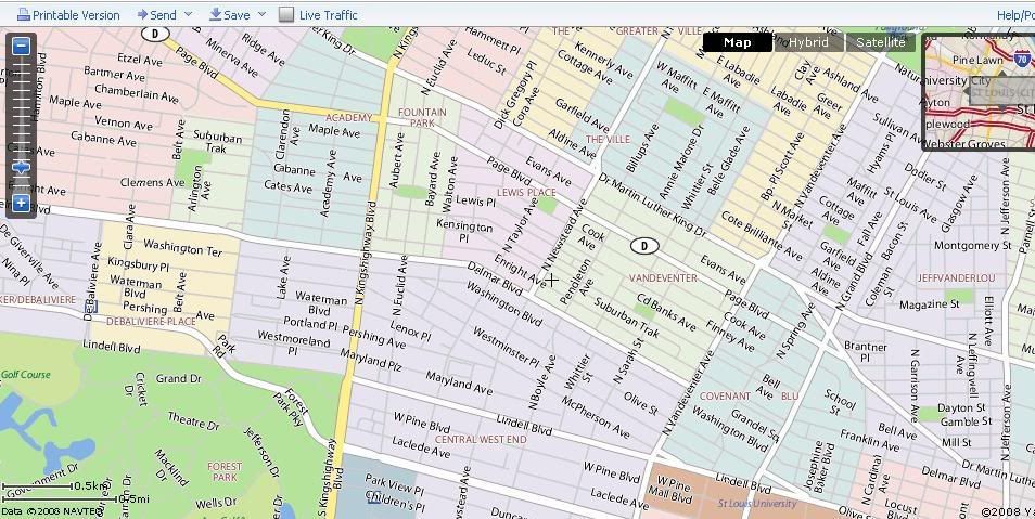
Map nerds beware: Yahoo Maps now features neighborhoods!

Doing a search for "restaurants" along Manchester in the Grove, I stumbled upon what I believe is a new feature of Yahoo! Maps: neighborhood boundaries.


Amazing!

For good measure, I checked Chicago and New Orleans to see if their nabes were so gracefully displayed as well. Indeed, Chicago's Wicker Park and New Orleans' Treme are featured alongside their respective neighborhood neighbors.

I used to despise Yahoo Maps. Their previous role seemed to be almost making Google look like a godsend in comparison. I still enjoy Google Maps (much quicker and more reliable), but Yahoo is on my radar.

Check it out.

More MCMs in the St. Louis blogosphere...

As I study the fights for and against mid century architecture preservation, I continually run across some sites that passionately advocate for the salvage of our "space age" construction.

Toby Weiss's B.E.L.T. has an excellent series of photographs and commentary on Overland's MCM stock. Some are quite impressive.

Steve Patterson's Urban Review St. Louis, which is currently guest editorials only due to his sudden illness (may he get better soon--St. Louis needs him!), features an editorial on what the role of the preservation community is in addressing threats to our mid century heritage. I particularly like the editorialist's suggestion that the former St. Louis Public Library Buder Branch, now the Record Exchange, at Hampton and Eichelberger be nominated to the National Register. See the (tiny) picture below.


Finally, St. Louis County has begun to recognize the value of its trove of MCM assets. You can read about their summary of modern architecture and their historic MCM sites here.

Fashion STL Style!

Fashion STL Style!
St. Louis Gives You the Shirt Off of Its Own Back!

Next American City

Next American City
Your Go-To Source for Urban Affairs

Join the StreetsBlog Network!

Join the StreetsBlog Network!
Your Source for Livable Streets

Trust in Rust!

Trust in Rust!
News from the Rustbelt

Dotage St. Louis -- Blogging the St. Louis Built Environment Since 2008

Topics: Historic Preservation, Politics and Government, Development, Architecture, Urban Planning, Urban Design, Local Business, Crime and Safety, Neighborhoods, and Anything Else Relating to Making St. Louis a Better City!