I took a stroll down the New Orleans riverfront the other day. It is, of course, notable because the riverfront is elevated above the rest of the city. Ironically, this unfortunate, flood-prone geologic reality is actually a civic and tourist draw. Passing ships literally hover above the city, even though the French Quarter is actually one of the highest elevated spots in the city.
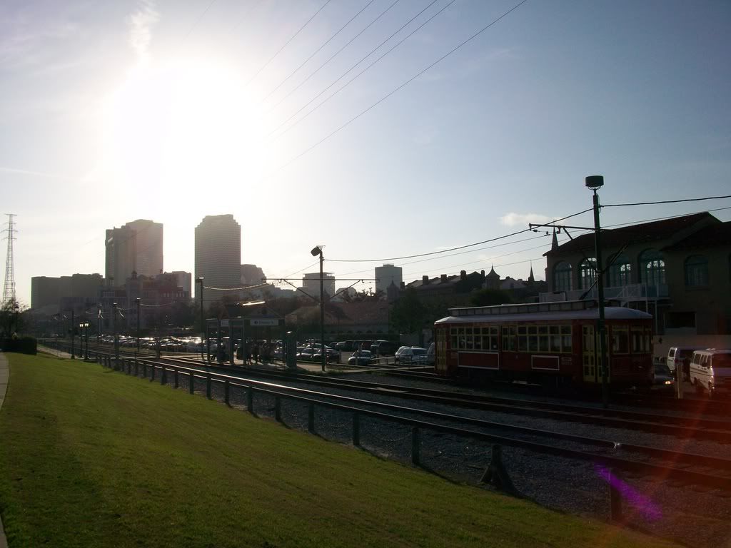
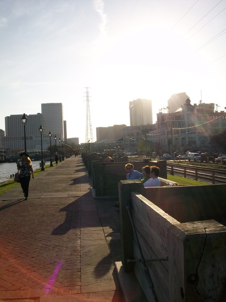
I think these pictures are important because they showcase how simple riverfront development can be. In New Orleans, it's really as simple as a paved walkway, some benches, attractive lighting, some artwork, good transit connections (yes--there's a streetcar line that runs along the riverfront!) and--the big one--active edges.
.While St. Louis suffers from an inherent lack of good edges which would cause pedestrians to want to traverse the length of the riverfront, it is partially a problem of marketing. For instance, the northern end of Laclede's Landing is wholly underutilized. The developed portion of Laclede's Landing could be rebranded into something of a residential area, especially if Lumiere buildings its proposed housing (pictured below--Phase II of the development).

As for the Arch and Eads Bridge, I would make a couple recommendations. The idea to transform the Eads Bridge archways into retail is amazing--but it would hinge on hiding the parking garage that currently faces the Bridge. The northern end of the Arch grounds is wholly unwelcoming. While in St. Louis this past December, I was walking on Washington Avenue in front of the bridge when a confused tourist from Dallas confessed to me he was about to give up looking for the 630-foot tall monument! I know it's an issue of grade, since the street is on a large slope that descends to the riverfront. Still, that is nothing some major surgery can't fix. Storefronts should face Washington Avenue on both sides just north of the Arch.
There is little to be done with the Archgrounds portion itself. Of course, the floodwall could and should be painted. And vendors, art installations, boat docks, etc. could enliven the actual riverfront itself.
The Chouteau's Landing portion, along with the Graffiti Wall, have loads of potential--a portion of which looks as if it's being explored. Having residents, as well as tourists and other visitors, in the immediate proximity is a must.
If all of these edges can be cultivated properly, a simple New Orleans treatment would be very appropriate. Let's take a look at some pictures.

The paved brick path is attractive, simple, and doable for St. Louis. This picture actually contains some aspects that a casual viewer might not realize applies to St. Louis as well. This view is looking across the Mississippi River toward a section of the city of New Orleans known as Algiers Point. There is a ferry that connects downtown New Orleans to Algiers--it's free to pedestrians and cyclists and only a buck for cars. Algiers is attractive, quaint, and is a minor attraction unto itself. So too should East St. Louis be that same foil to downtown St. Louis. Not a show-stealer, but a nice complement to the attractions on the other side of the river. And there need to be better connections between the two, too. Lighting the Eads Bridge is one way to draw attention to an existing connections.
The other issue is...take a look at the Crescent City Connection, the twin bridges in the photograph above. They're lit at night and visible from across the low-lying city. They're not anything spectacular, but they do symbolize a grand and important passage over a great river. The Poplar Street Bridge? Not so much. Instead of building a new bridge over the river to the north of downtown St. Louis, the Poplar should receive a much, much needed upgrade.

In this photograph, a restored red trolley car rolls on the Riverfront Streetcar line adjacent to the Mississippi River. The line terminates at Esplanade Avenue, a beautiful tree-lined boulevard that serves as a delightful edge to the French Quarter (it's also where I live!). The streetcar then runs along the riverfront for the length of the Quarter, the Central Business District, and the Warehouse District, ending at the Convention Center--about a mile and a half run.
St. Louis isn't at the point where a streetcar line along the riverfront would really attract a critical mass of passengers to justify it. However, if there is aggressive redevelopment of Chouteau's and Laclede's Landings, this could change.

This is an actively used space. In fairness, this picture was taken yesterday--a Saturday--when it was 80 degrees outside. Even so, even on colder days you will always witness joggers and camera-laden tourists (that's my shadow!).

I'm not sure why these planters were emptied--dead trees, perhaps. And New Orleans has a noticeable problem with less-than-creative graffiti. Since this is technically a City Park, it does "close" at night, which tends to empty it out and allow taggers to complete their "works". Still, the planters and benches offer a place for weary riverfront admirers to relax, and, when trees are restored to their proper place, some shade as well. The skyline of New Orleans--which I do not find overly attractive at all--at least lends a strikingly urban feel to this riverwalk.

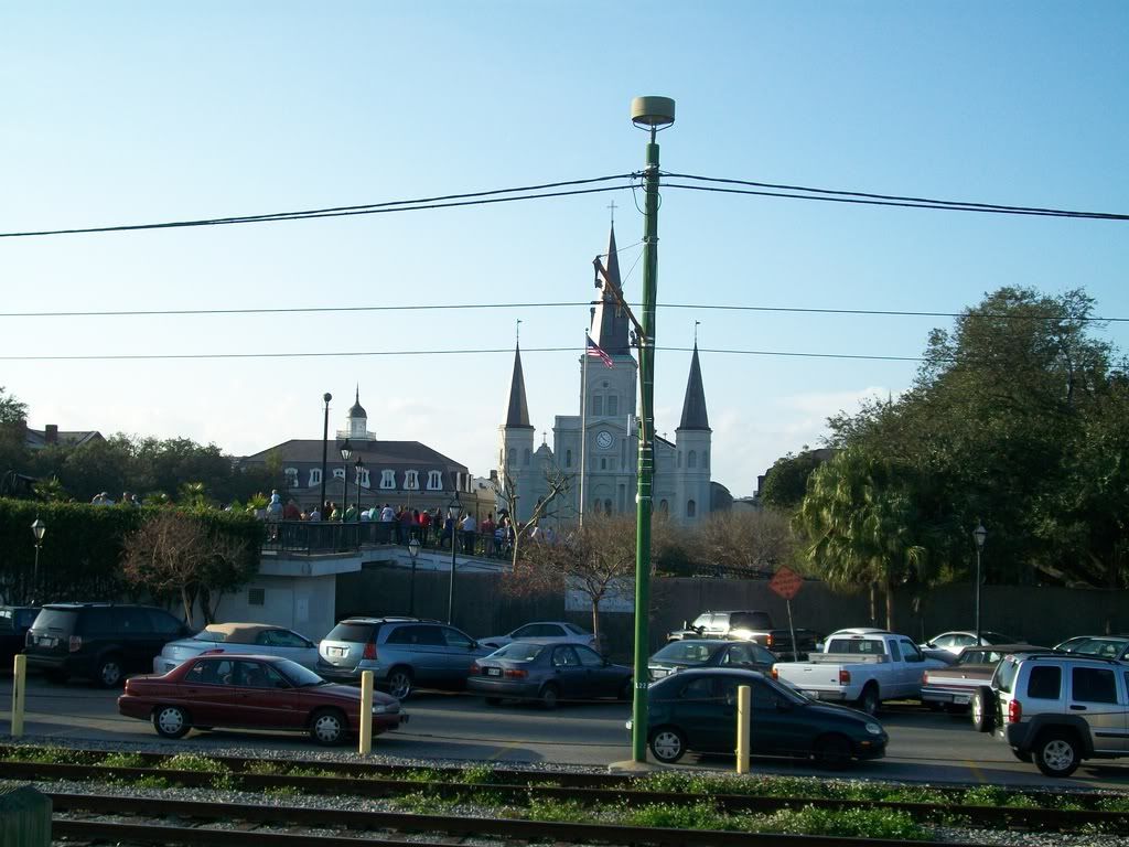
The St. Louis Cathedral is located some 1,000 feet from the riverfront, separated by a floodwall and a narrow parking lot. Yet, the spillover of pedestrians is tremendous. The Cathedral is the city of New Orleans' "Gateway Arch"--the popular symbol of the city and one of its largest tourist attractions. The transition here between monument and riverfront is not seamless, as one can see. But the whole spine, Decatur Street, along the riverfront is an active space, and those wanting to briefly escape hyper-urbanism can enjoy the respite that the more subdued riverfront brings.

This is a view of Decatur Street, poking out above the foodwall.

There are numerous statues and sculptures along the Riverfront, but I found this Holocaust Memorial very intriguing. It's interactive art. A sign to interpret the installation exists on one end, along with a description of each different view of the changing kaleidoscope of images. If you stand in one spot, you're viewing one symbolic stage of the Holocaust. Above is the first stage. Interactive, dynamic art is essential to well-used public spaces. It enlivens them. When strategically placed and strewn about the space, each installation can be a discovery that the casual repeat-visitor may not even have noticed before or never took the time to stop at before.
I have many more pictures of the riverfront in New Orleans, but these should suffice for now. Redeveloping St. Louis's riverfront will require thinking of urban spaces in terms of their connectivity as well as their functionality. Downtown St. Louis should not be a series of "districts" with highways, vacant lots, or bland corporate campuses separating them. It is essential to restitch downtown and reduce the deadening visibility of those dividing seams. If the city, its leaders, residents, and business owners, can convince St. Louisans and visitors alike that the riverfront is an asset and that the location is excellent for both commerce and residence, then riverfront redevelopment can be successful. It might even be simple, with the New Orleans treatment shown above.


0 comments:
Post a Comment